
This borehole measures water levels in the Lincolnshire Limestone Formation, to the east of Grantham, England.
BGS Enquiries can help you to access data from the National Groundwater Level Archive (NGLA) for this well.
Hydrograph
Information about the well
Hydrogeological setting
| New Red Lion | |
|---|---|
| Wellmaster ID | TF03/37 |
| NGR | 5088 3303 |
| Datum | 33.45 m AOD |
| Monitoring details | |
| Type | Groundwater level |
| Aquifer | Jurassic limestone |
| Confinement | Varies from unconfined to confined |
| Depth | 50 m |
| Record | |
| Monitored by | EA Anglian |
| Records commence | 1964 |
| Records end | Active |
The borehole penetrates:
- Kellaways Formation
- Cornbrash Formation
- Blisworth Clay Formation
- Blisworth Limestone Formation
- Rutland Formation
- Lincolnshire Limestone Formation
- Grantham Formation
The aquifer varies from unconfined at minimum water levels (when the water levels are within the Lincolnshire Limestone Formation) to confined at maximum water levels (with water levels against the Blisworth Limestone Formation, which is cased out).
Well or borehole construction
The well is lined with 127 mm-diameter lining tubes to a depth of 25 m; it is then 114 mm diameter open hole to a full depth of 50 m.
Hydrograph response
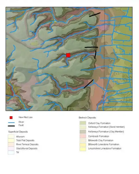

Map of New Red Lion showing geology and water level contours. BGS © UKRI.
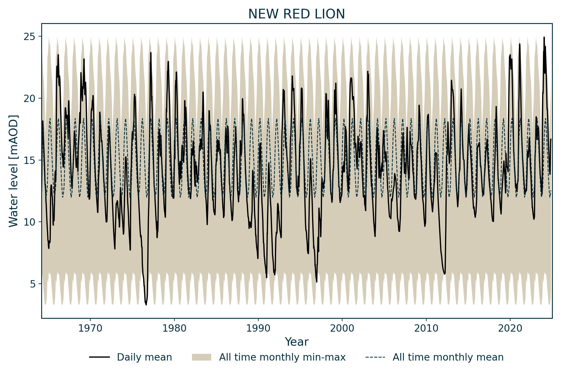
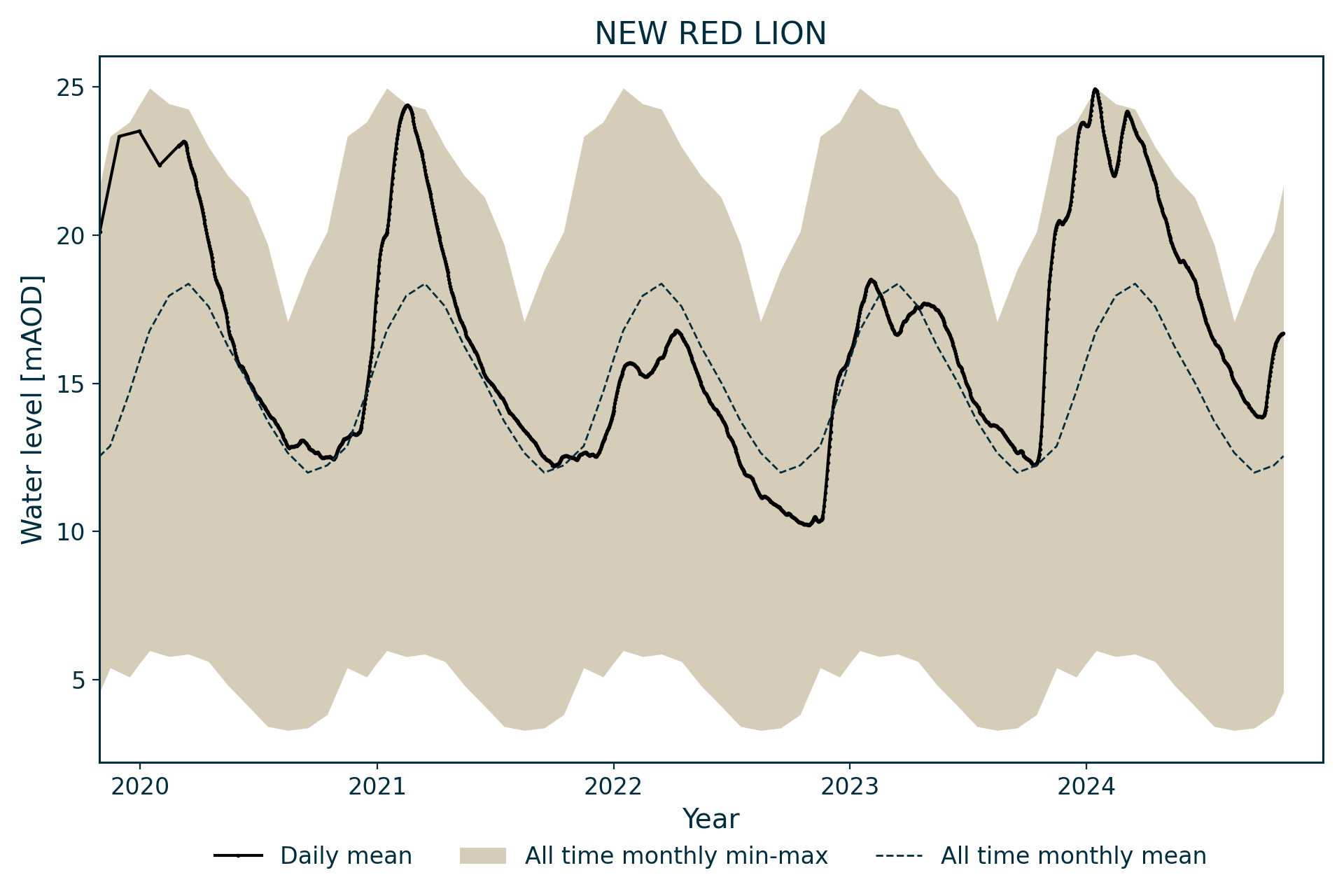
The hydrograph has an annual sinusoidal appearance with up to 20 m interannual variation. The hydrograph hints at some regional declines in water levels during the late 1960s and and through to 1990, but compensated by recoveries during wet winters. Since 2000, levels have shown more stability.
Data issues
This borehole has been monitored from April 1984 replacing a borehole at Old Red Lion (reference TF03/3, TF 08773039, OD +37.55 m), of a similar depth, 94 m away, which was monitored from March 1964 to January 1981. The records for the period from 21 January 1981 to 31 March 1982 and for 26 April 1982 have been extrapolated from another observation well into the Lincolnshire Limestone Formation at Threekingham (TF 0933 3600), a distance of 5.6 km.
Acknowledgements
Groundwater level data are provided to the NGLA by the Environment Agency (EA), Natural Resources Wales – Cyfoeth Naturiol Cymru (NRW), the Scottish Environment Protection Agency (SEPA) and, for Northern Ireland, the Department for Infrastructure – Rivers and the Northern Ireland Environment Agency.
Further information about these monitoring networks can be found on these pages:
Contact
Please contact BGS Enquiries for further information.