
This well is used to measure water levels in the Lower Greensand Group aquifer to the north-east of Lewes in south-east England.
BGS Enquiries can help you to access data from the National Groundwater Level Archive (NGLA) for this well
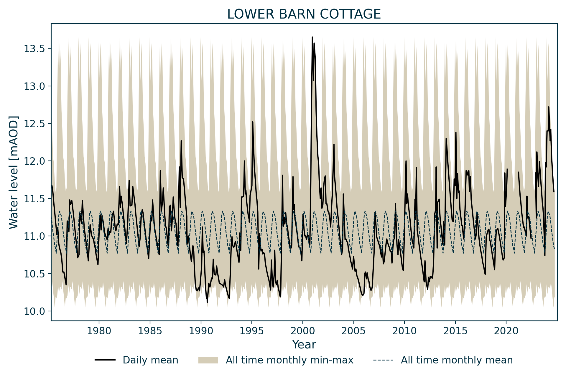
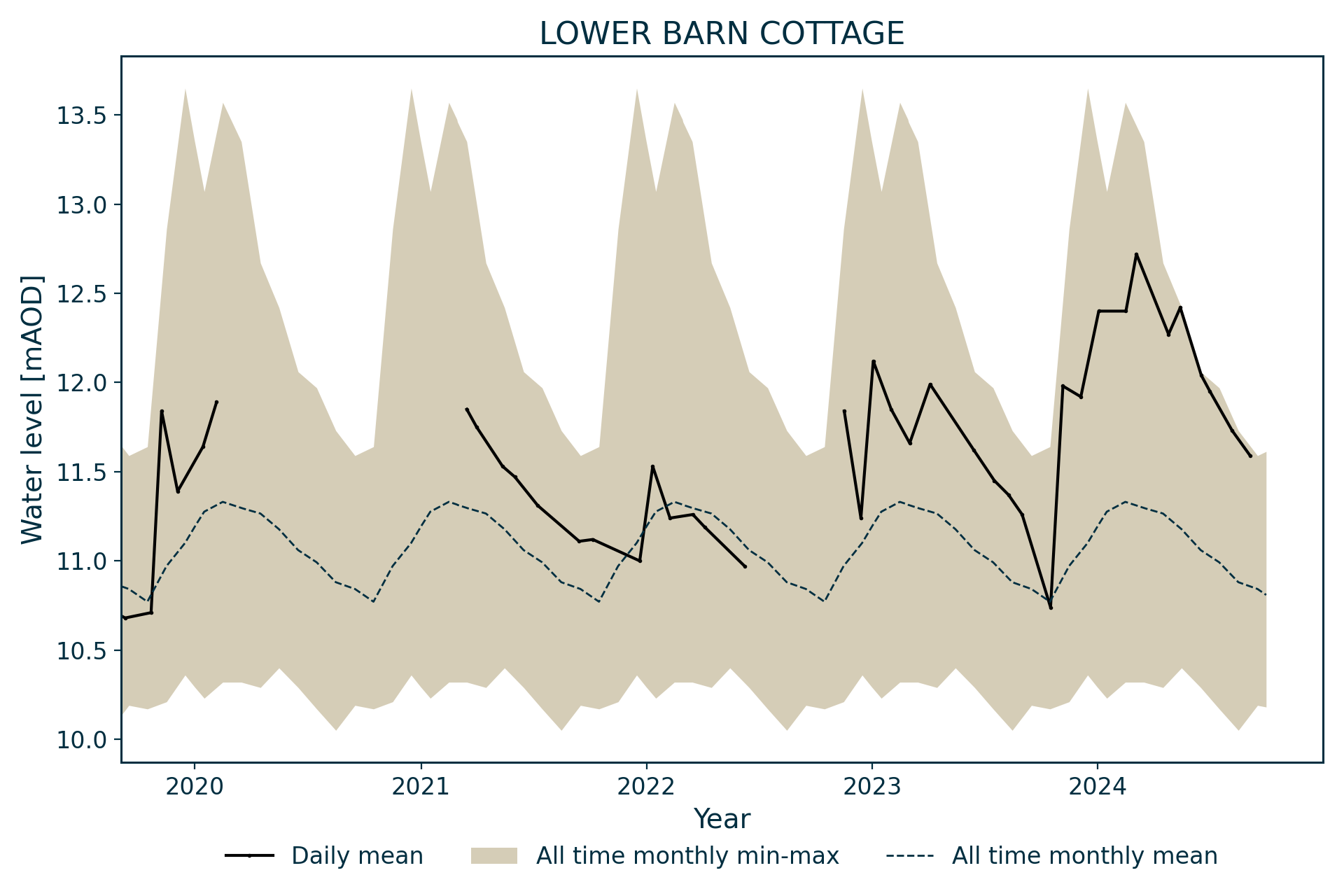
Hydrograph
Information about the well
Hydrogeological setting
| Lower Barn Cottage | |
|---|---|
| Wellmaster ID | TQ41/82 |
| NGR | 5437 1132 |
| Datum | 18.02 m AOD |
| Monitoring details | |
| Type | Groundwater level |
| Aquifer | Lower Greensand Group |
| Confinement | Unconfined |
| Depth | 8.25 m |
| Record | |
| Monitored by | EA South East |
| Records commence | 1975 |
| Records end | 2012 |
The well penetrates 8.25 m of the Lower Greensand Group.
Well or borehole construction
The diameter and construction details of the well are unknown.
Hydrograph response
The aquifer is unconfined and the hydrograph has an annual sinusoidal appearance.
Acknowledgements
Groundwater level data are provided to the NGLA by the Environment Agency (EA), Natural Resources Wales – Cyfoeth Naturiol Cymru (NRW), the Scottish Environment Protection Agency (SEPA) and, for Northern Ireland, the Department for Infrastructure – Rivers and the Northern Ireland Environment Agency.
Further information about these monitoring networks can be found on these pages:
Contact
Please contact BGS Enquiries for further information.