
The Llanfair Dyffryn Clwyd borehole measures groundwater levels in the Triassic-aged Kinnerton Sandstone Formation near Rhuthun (Ruthin) in the Vale of Clywd, north Wales.
BGS Enquiries can help you to access data from the National Groundwater Level Archive (NGLA) for this well.
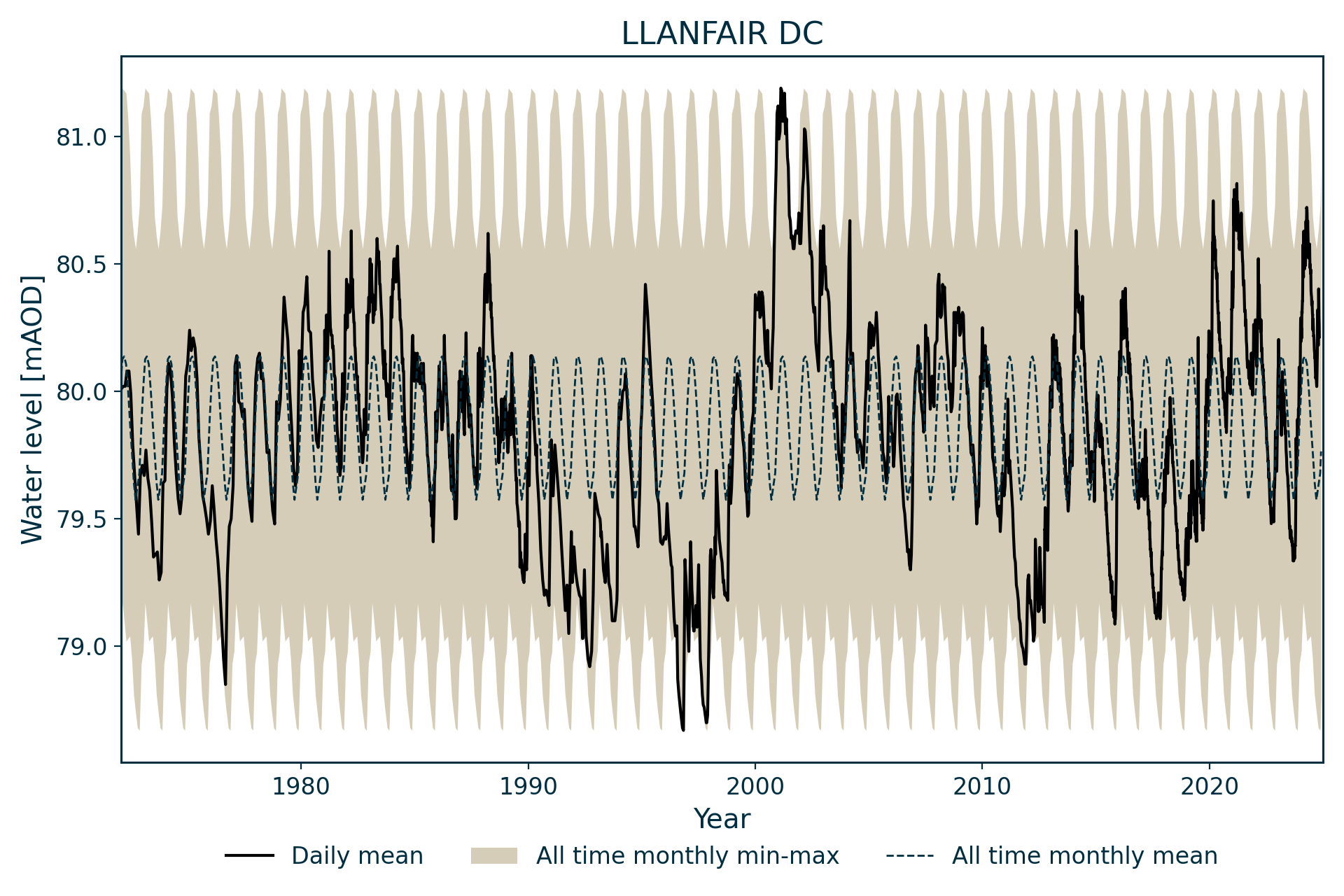
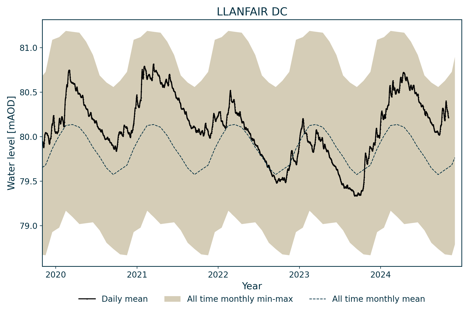
Hydrograph
Information about the well
Hydrogeological setting
| Llanfair DC | |
|---|---|
| Wellmaster ID | SJ15/13 |
| NGR | 3137 3555 |
| Datum | 83.08 m AOD |
| Monitoring details | |
| Type | Groundwater level |
| Aquifer | Permo–Triassic sandstone |
| Confinement | Confined |
| Depth | 121.9 m |
| Record | |
| Monitored by | Natural Resources Wales |
| Records commence | 1972 |
| Records end | Active |
The borehole is in the Vale of Clywd and representative of levels within the important Permo-Triassic Sandstone aquifer.
The borehole is drilled into the Kinnerton Sandstone Formation and is overlain by till deposits. It is possible that the sandstones are in hydraulic continuity with Carboniferous limestone, which may contribute water to the aquifer.
The observed water levels are within the till, rather than the sandstones, implying that the sandstone aquifer is confined.
Well or borehole construction
The well is 121.9 m deep, lined to 18.59 m, with a diameter of 248 mm reducing to 146 mm at depth. It was drilled as a purpose-built observation well, with a secondary aim of establishing the geological succession.
The driller’s log identifies a very porous zone between 98.8 and 100.6 m below ground level.
Hydrograph response
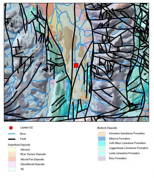

Map of Llanfair Dyffryn Clwyd showing geology and water level contours. BGS © UKRI.
The hydrograph shows a spiky annual sinusoidal pattern, within a relatively restricted range, with fluctuations generally less than 1 m per annum.
Long-term trends are apparent in the data, with a slow rise through the 1970s, generally falling levels from 1985 to the mid 1990s and a relatively marked increase in levels to a record high in 2002. Since 2002, levels have fallen back slightly and appear to be relatively stable. It is assumed that these fluctuations reflect long-term changes in catchment water balance.
Data issues
Considered to be good, reliable data.
The borehole was previously numbered SJ15/15.
Acknowledgements
Groundwater level data are provided to the NGLA by the Environment Agency (EA), Natural Resources Wales – Cyfoeth Naturiol Cymru (NRW), the Scottish Environment Protection Agency (SEPA) and, for Northern Ireland, the Department for Infrastructure – Rivers and the Northern Ireland Environment Agency.
Further information about these monitoring networks can be found on these pages:
Contact
Please contact BGS Enquiries for further information.