
This well is in Kent, south-east England, and is used to measure water level in the Cretaceous-aged Holywell Nodular Chalk Formation.
BGS Enquiries can help you to access data from the National Groundwater Level Archive (NGLA) for this well
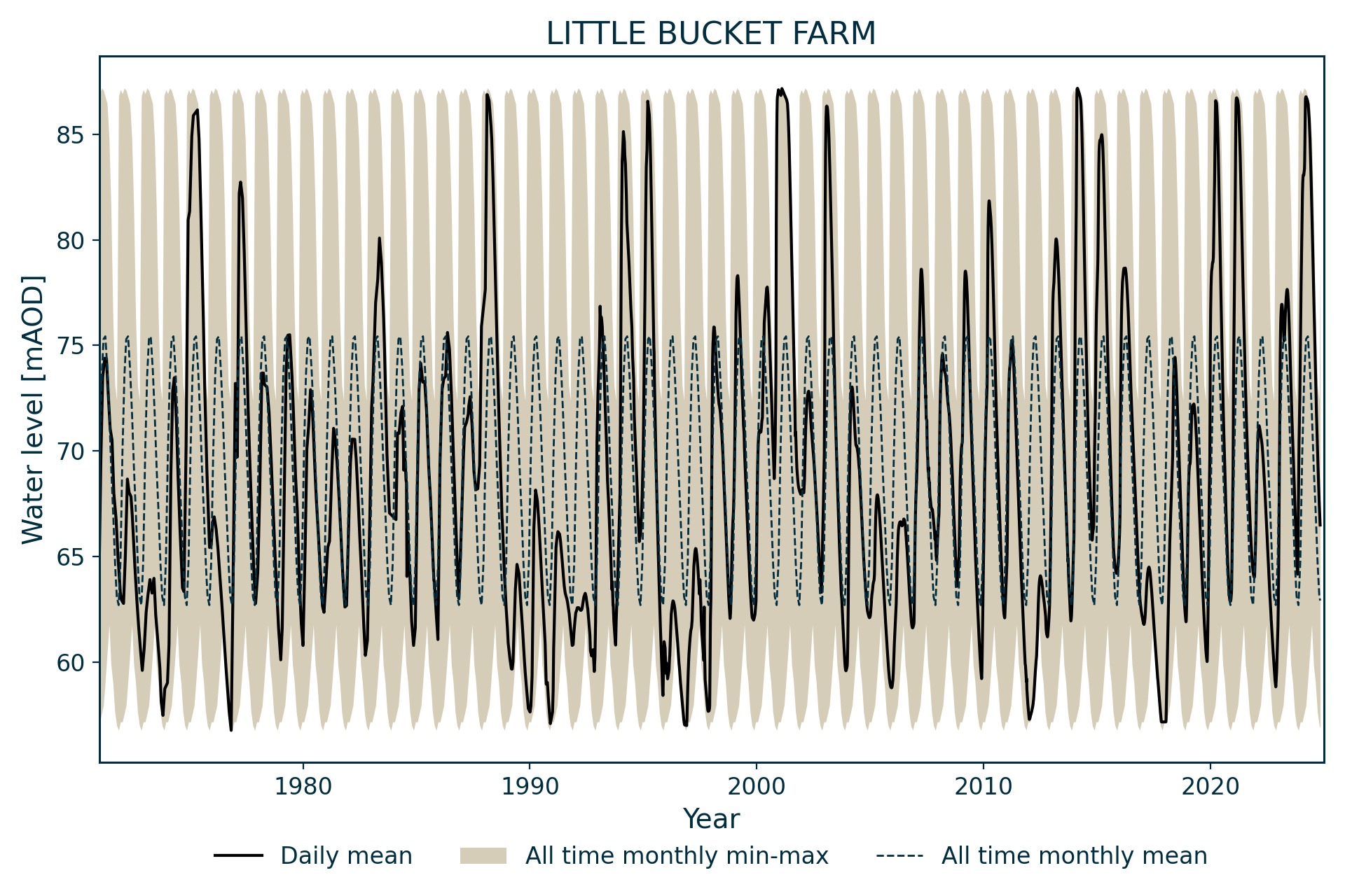
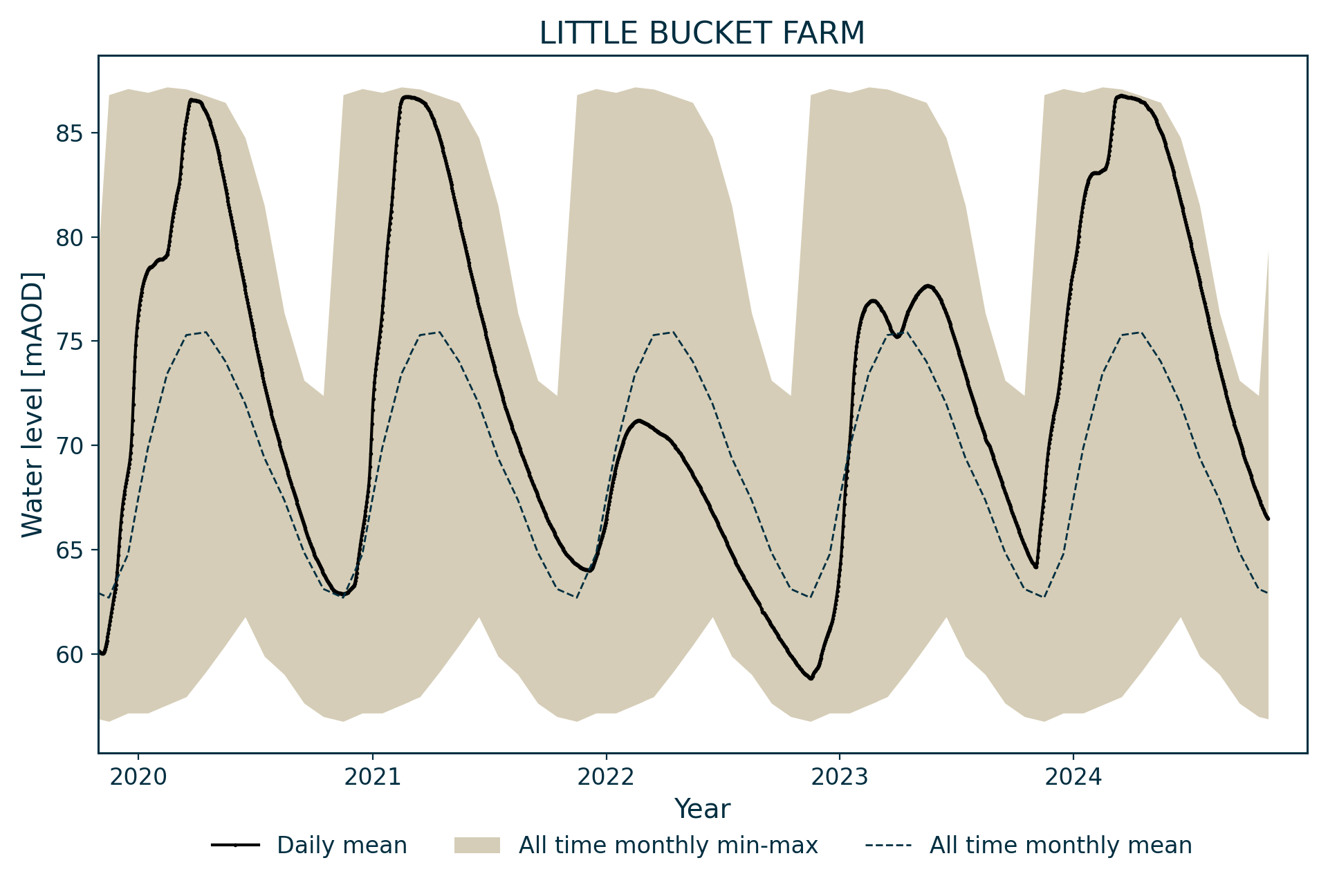
Hydrograph
Information about the well
Hydrogeological setting
| Little Bucket Farm | |
|---|---|
| Wellmaster ID | TR14/9 |
| NGR | 6122 1469 |
| Datum | 87.33 m AOD |
| Monitoring details | |
| Type | Groundwater level |
| Aquifer | Chalk |
| Confinement | Unconfined |
| Depth | 31.33 m |
| Record | |
| Monitored by | EA Southern |
| Records commence | 1971 |
| Records end | Active |
This well measures water levels in the Chalk Group aquifer of Kent, which is unconfined at this site. It is dug into the Holywell Nodular Chalk Formation overlain by thin head (silt and gravel) deposits.
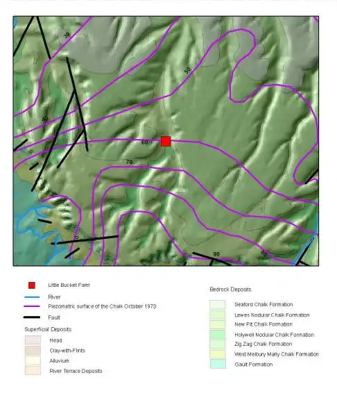

Geological map of the area around Little Bucket Farm. BGS © UKRI.
Well or borehole construction
The well was originally sunk for a household water supply and subsequently adopted as an observation well after a period of disuse. The well is 0.84 m in diameter and 31.33 m deep.
Hydrograph response
The hydrograph has an annual sinusoidal appearance. Annual fluctuations are normally around 10 m, but have been as high as 2 m in some exceptional years. The extreme limits of its fluctuation are constrained by the well construction, with water nearing ground level in wet years and the well effectively drying up in the driest years.
Data issues
Logger installed.
References
Finch, J, Marsh, T, and McKenzie, A A. 2007. A preliminary risk assessment of the potential for groundwater flooding during the winter of 2007/8 — an update. (Wallingford, UK: NERC/Centre for Ecology and Hydrology-British Geological Survey.)
Acknowledgements
Groundwater level data are provided to the NGLA by the Environment Agency (EA), Natural Resources Wales – Cyfoeth Naturiol Cymru (NRW), the Scottish Environment Protection Agency (SEPA) and, for Northern Ireland, the Department for Infrastructure – Rivers and the Northern Ireland Environment Agency.
Further information about these monitoring networks can be found on these pages:
Contact
Please contact BGS Enquiries for further information.