
This well is used to monitor water levels in the Carboniferous-aged Eyam Limestone Formation and Monsal Dale Limestone Formation in the Peak Limestone Group unconfined aquifer in Derbyshire, England.
BGS Enquiries can help you to access data from the National Groundwater Level Archive (NGLA) for this well.
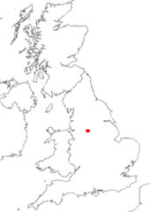

Location of Hucklow South. BGS © UKRI.
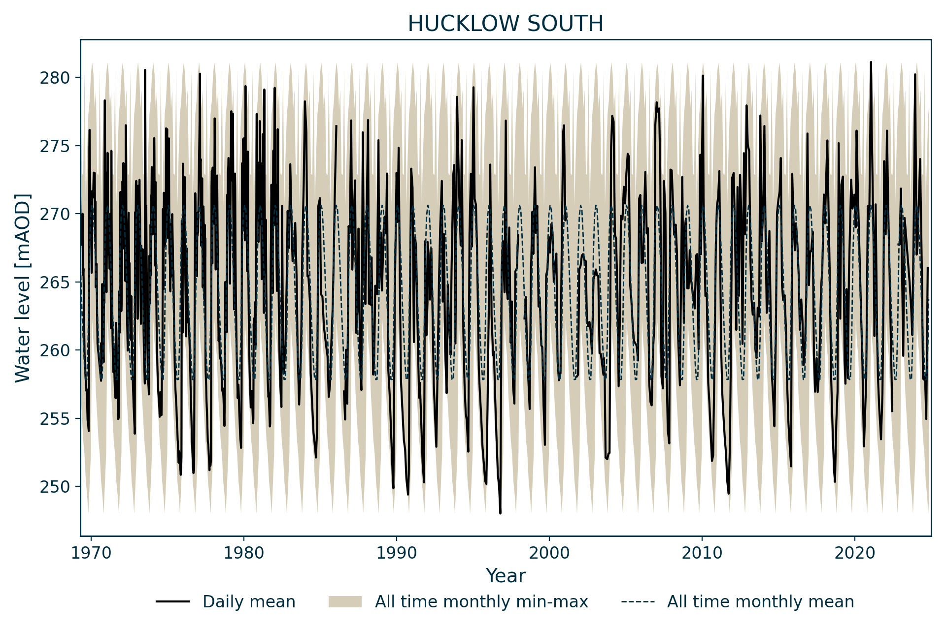
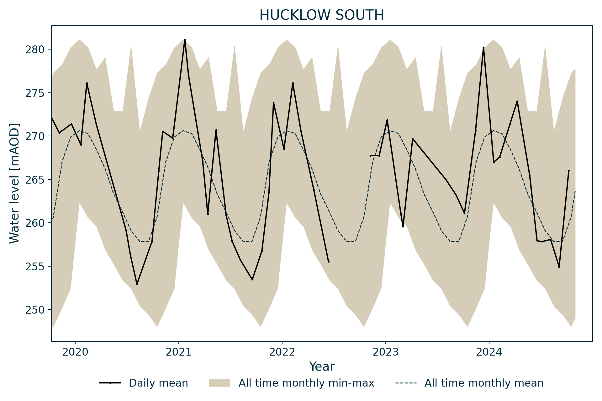
Hydrograph
Information about the well
Hydrogeological setting
| Hucklow South | |
|---|---|
| Wellmaster ID | SK17/13 |
| NGR | 4177 3775 |
| Datum | 301.8 m AOD |
| Monitoring details | |
| Type | Groundwater level |
| Aquifer | Carboniferous limestone |
| Confinement | Unconfined |
| Depth | 123.6 m |
| Record | |
| Monitored by | EA Midlands |
| Records commence | 1969 |
| Records end | 2012 |
No superficial deposits are mapped as being present at the site, but 2.4 m of clay and stones (till) were encountered when drilling. Beneath this, the borehole passes through 42.1 m of Eyam Limestone Formation and 75.3 m of Monsal Dale Limestone Formation, both part of the Peak Limestone Group. The borehole ends in about 27 m of volcanic rocks.
The water is unconfined, with a large seasonal range of about 25 m. The water level fluctuates between the Eyam and Monsal Dale limestone formations. The borehole is likely to be fully penetrating, as it is probable that the Litton Tuff Member and Cressbrook Dale Lava Member form an effective base to the aquifer.

Geological map of the area around Hucklow South. BGS © UKRI.
Well or borehole construction
The length of lining tubes installed in the borehole is unknown.
Hydrograph response
The hydrograph overall has an annual sinusoidal appearance, but more than one peak can occur in a year due to responses to rainfall events.
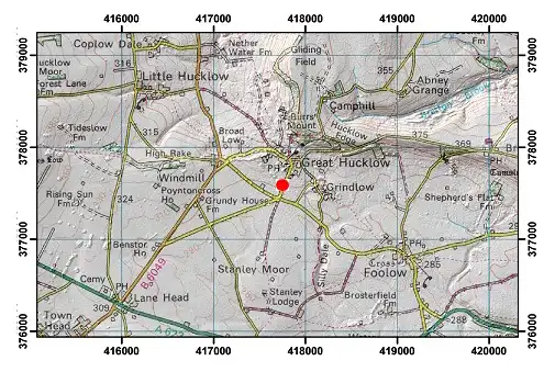
Topographical map with hillshade of the area around Hucklow South. BGS © UKRI.
Acknowledgements
Groundwater level data are provided to the NGLA by the Environment Agency (EA), Natural Resources Wales – Cyfoeth Naturiol Cymru (NRW), the Scottish Environment Protection Agency (SEPA) and, for Northern Ireland, the Department for Infrastructure – Rivers and the Northern Ireland Environment Agency.
Further information about these monitoring networks can be found on these pages:
Contact
Please contact BGS Enquiries for further information.