
The well at Grimes Graves is used to measure water levels in the unconfined Chalk aquifer to the north-west of Thetford, Norfolk.
BGS Enquiries can help you to access data from the National Groundwater Level Archive (NGLA) for this well
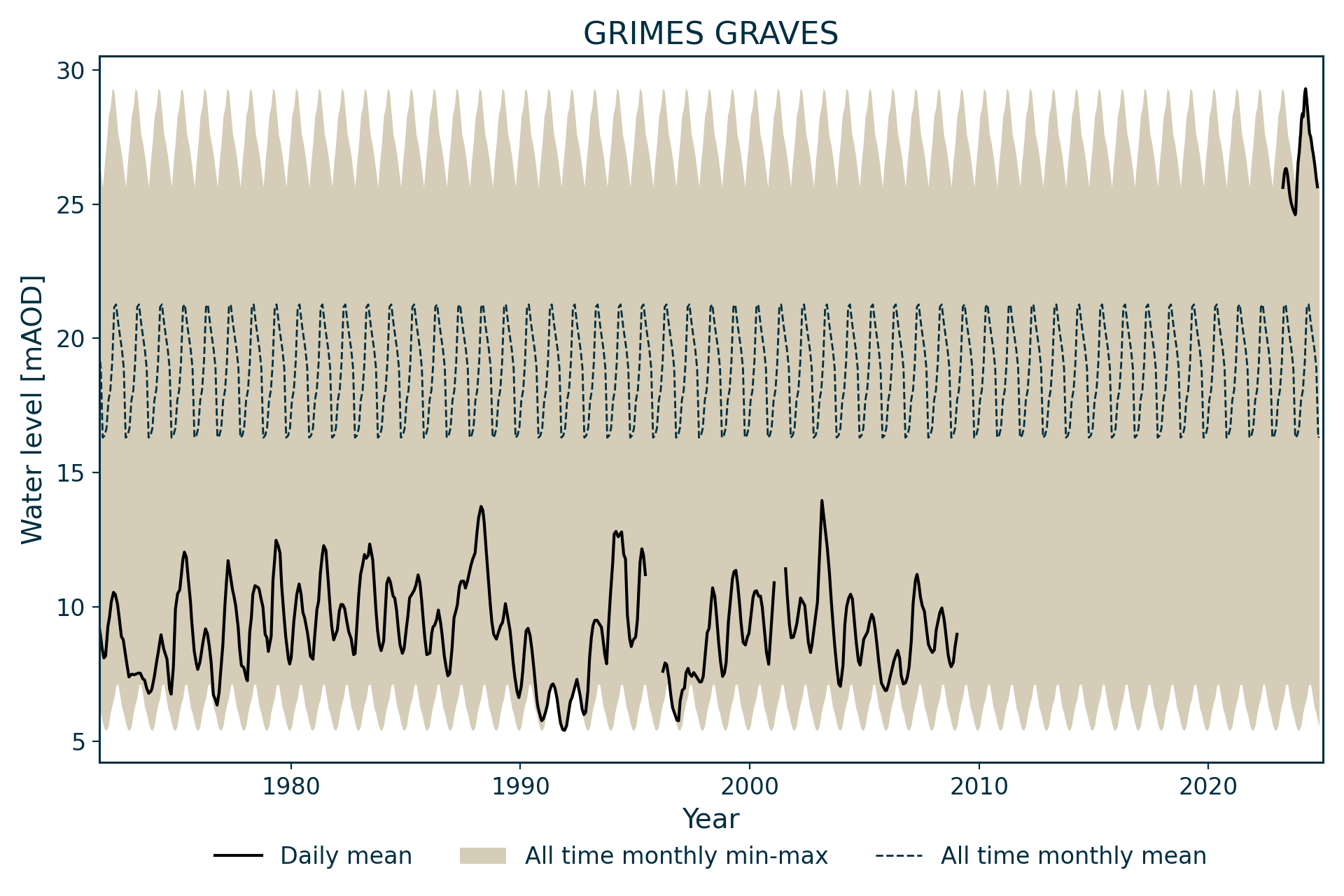
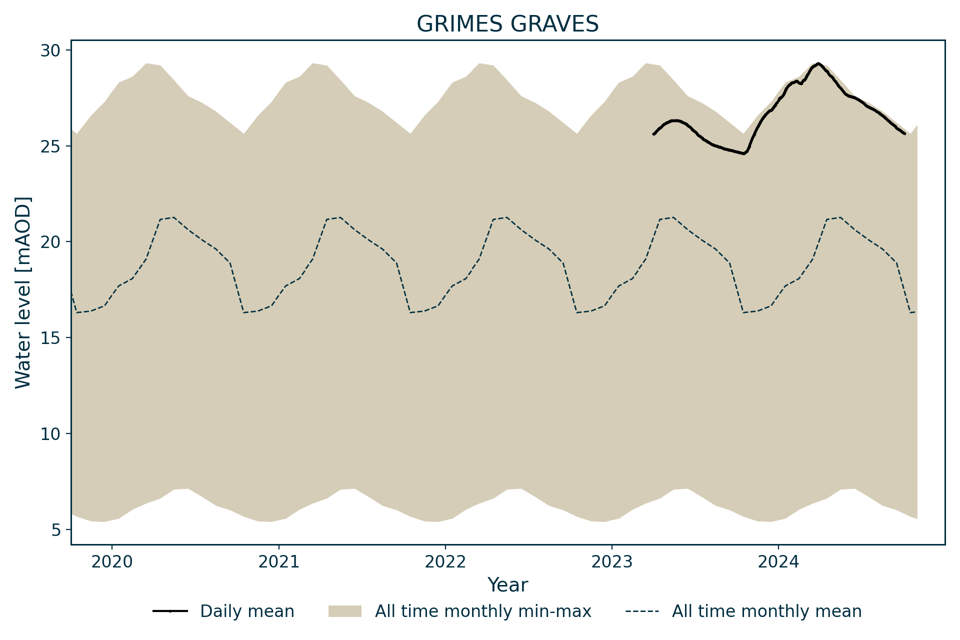
Hydrograph
Records for this site end in 2008.
Information about the well
Hydrogeological setting
| Grimes Graves | |
|---|---|
| Wellmaster ID | TL89/37 |
| NGR | 5817 2900 |
| Datum | 17.22 m AOD |
| Monitoring details | |
| Type | Groundwater level |
| Aquifer | Chalk |
| Confinement | Unconfined |
| Depth | 26 m |
| Record | |
| Monitored by | EA Anglian |
| Records commence | 1971 |
| Records end | 2008 |
The site lies on the margin of the cover sand and a very small thickness of this deposit may be present above the Chalk. The borehole penetrates the New Pit Chalk Formation. The Chalk aquifer is unconfined at this site.
Well or borehole construction
The borehole was drilled at 120 mm diameter. It is not recorded as having any casing, though there is likely to be at least a short section at the surface.
Hydrograph response
Unconfined Chalk with hydrograph exhibiting an annual sinusoidal response.
Acknowledgements
Groundwater level data are provided to the NGLA by the Environment Agency (EA), Natural Resources Wales – Cyfoeth Naturiol Cymru (NRW), the Scottish Environment Protection Agency (SEPA) and, for Northern Ireland, the Department for Infrastructure – Rivers and the Northern Ireland Environment Agency.
Further information about these monitoring networks can be found on these pages:
Contact
Please contact BGS Enquiries for further information.