
This well is used to monitor the water level in the Permo–Triassic-aged St Bees Sandstone Member (Chester Formation) aquifer of Barrow-in-Furness, Cumbria, north-west England.
BGS Enquiries can help you to access data from the National Groundwater Level Archive (NGLA) for this well.
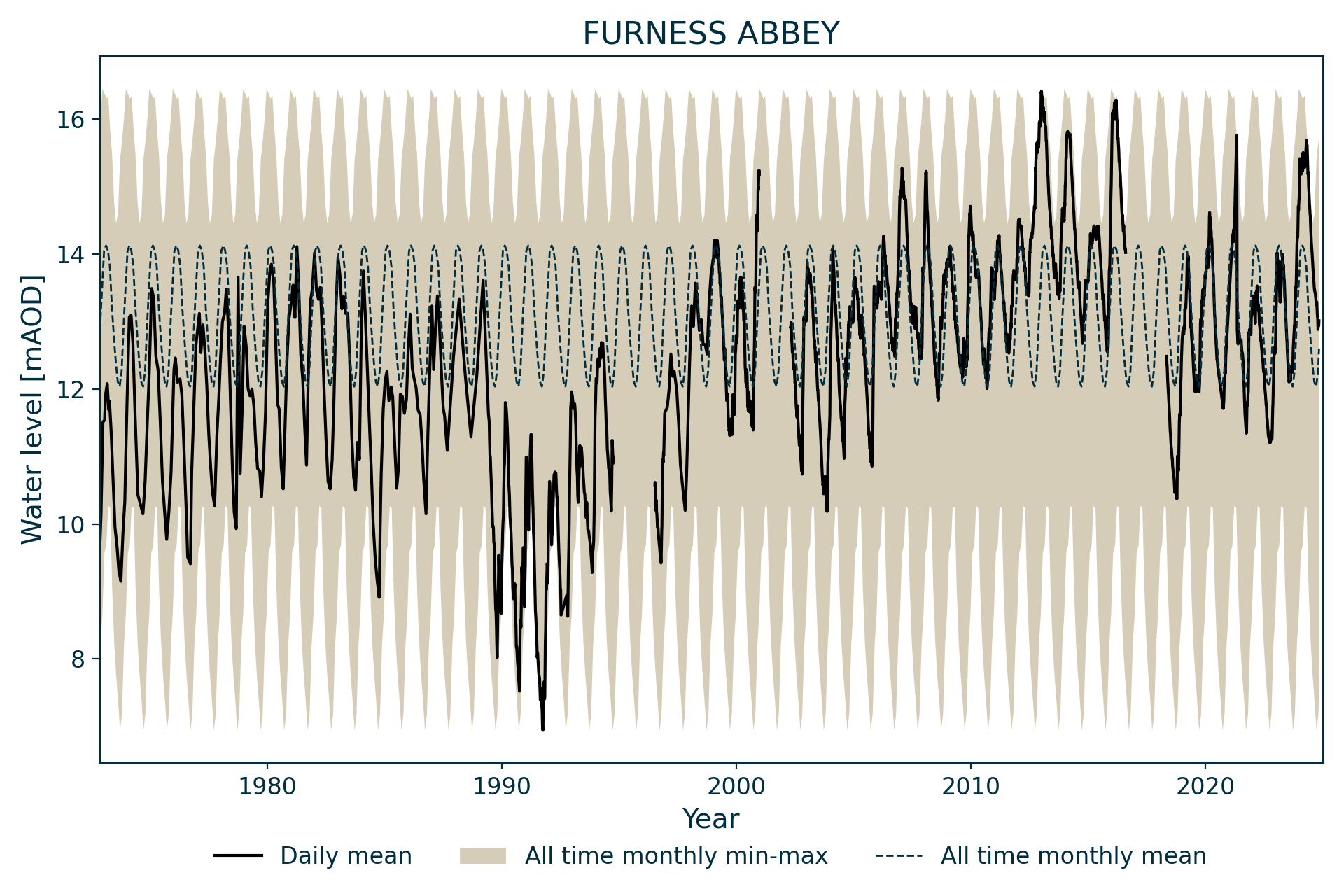
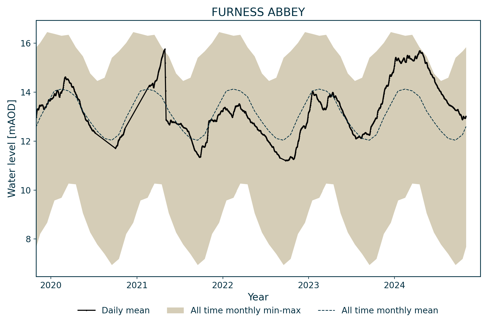
Hydrograph
Information about the well
Hydrogeological setting
| Furness Abbey | |
|---|---|
| Wellmaster ID | SD27/6B |
| NGR | 3216 4717 |
| Datum | 20.16 m AOD |
| Monitoring details | |
| Type | Groundwater level |
| Aquifer | Permo–Triassic sandstone |
| Confinement | Confined |
| Depth | 91.7 m |
| Record | |
| Monitored by | EA North West |
| Records commence | 1971 |
| Records end | 2008 |
The borehole penetrates 6.1 m of till (sandy clay), beneath which it passes through 57.5 m of St Bees Sandstone Member (part of the Sherwood Sandstone Group) of Permo-Triassic age).
The aquifer is confined by the overlying till at certain times of the year, with maximum water levels rising above the top of the aquifer. The site is located 930 m to the west of the Yarlside Fault, which marks the eastern margin of the down-faulted aquifer in the Permo-Triassic age basin.
Well or borehole construction
There is some doubt over the position and depth of the casing, as there are two versions of the record. One has the 20.4 m of casing starting 0.9 m above ground level and the other with 20.4 m of casing starting 0.9 m below ground level; the latter has been assumed to be correct.
Hydrograph response
The hydrograph has an annual sinusoidal, but spiky, appearance.
Data issues
Data is missing from October 1994 to July 1996, from December 2000 to April 2002, and post-2007.
Acknowledgements
Groundwater level data are provided to the NGLA by the Environment Agency (EA), Natural Resources Wales – Cyfoeth Naturiol Cymru (NRW), the Scottish Environment Protection Agency (SEPA) and, for Northern Ireland, the Department for Infrastructure – Rivers and the Northern Ireland Environment Agency.
Further information about these monitoring networks can be found on these pages:
Contact
Please contact BGS Enquiries for further information.