
The well at Dalton Holme is drilled into the Cretaceous-aged Burnham Chalk Formation, through a thin drift cover, to the north-west of Hull in Yorkshire. Our records of the water level in this well date back to 1889. The well is 1.5 m wide — almost big enough to lie down in!
BGS Enquiries can help you to access data from the National Groundwater Level Archive (NGLA) for this well.
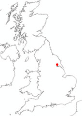

Location of Dalton Holme. BGS © UKRI.
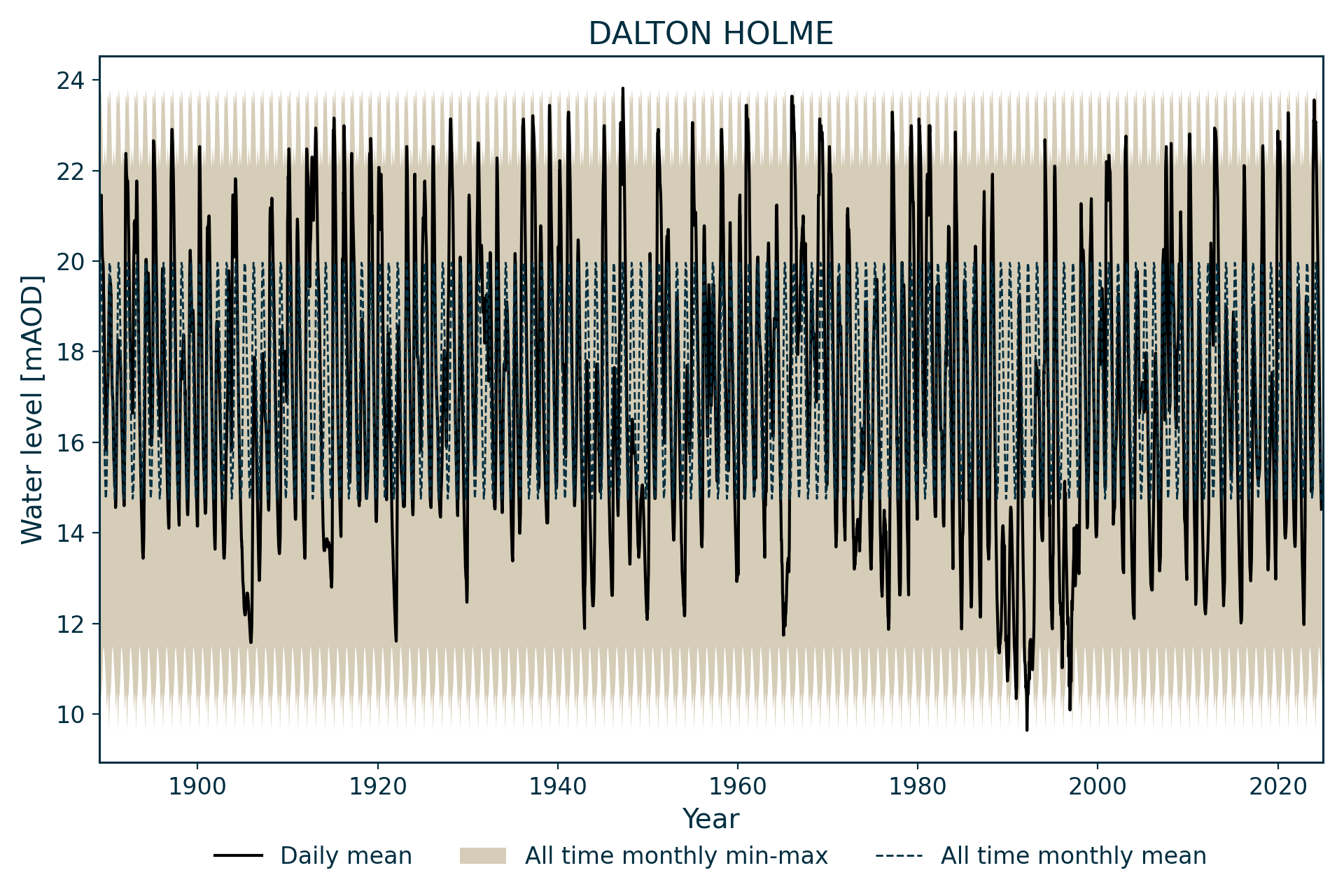
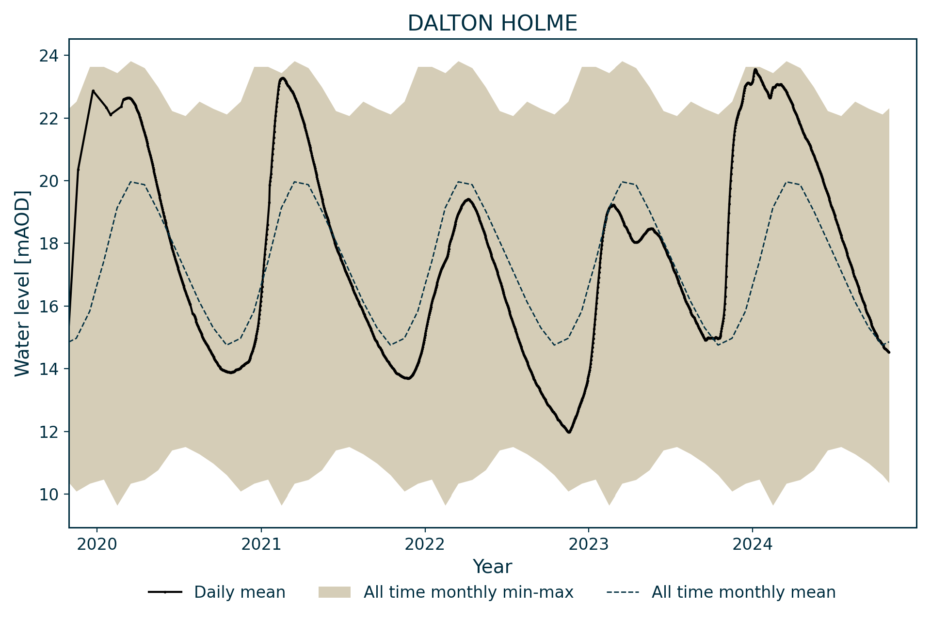
Hydrograph
Information about the well
Hydrogeological setting
| Dalton Holme | |
|---|---|
| Wellmaster ID | SE94/5 |
| NGR | 4965 4453 |
| Datum | 34.5 m AOD |
| Monitoring details | |
| Type | Groundwater level |
| Aquifer | Chalk |
| Confinement | Confined |
| Depth | 28.5 m |
| Record | |
| Monitored by | EA North East |
| Records commence | 1889 |
| Records end | Active |
This well measures water level in the Chalk Group to the north-west of Hull.

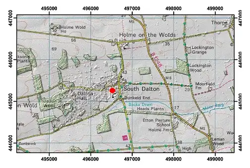
Geological map of the area around Dalton Holme. BGS © UKRI.
Well or borehole construction
The original 1.5 m-diameter shaft on the site is thought to have been dug in 1876 to 28.5 m depth. A 460 mm bore was drilled through the base of the shaft in 1946 and plain lining (depth unknown) was inserted.
The well was constructed for a domestic water supply and is regularly pumped.
A borehole was drilled 10 m from the well in 1990.
Hydrograph response
The hydrograph has a broadly sinusoidal appearance, with an absolute recorded range of 14.8 m, although annuual fluctuations are typically around 7 m. The groundwater levels at Dalton Holme respond relatively slowly to rainfall, perhaps influenced by the drift cover.
The minimum recorded level is 9.64 m AOD, on 14 February 1992, and the maximum recorded water level is 23.82 m AOD on 30 March 1947. There does appear to be some constraint in both minima and maxima. As the well neither dries up nor overflows, this implies some regional stratigraphical control on levels.
Data issues
Weekly levels were measured from 1889. A chart recorder was fitted in 1977 and continuous digital recording started in 1986.
References
Finch, J, Marsh, T, and McKenzie, A A. 2007. A preliminary risk assessment of the potential for groundwater flooding during the winter of 2007/8 — an update. (Wallingford, UK: NERC/Centre for Ecology and Hydrology-British Geological Survey.)
Monkhouse, R A. 1992. Long-term hydrograph of groundwater levels in the Dalton Holme Estate well in the Chalk of Yorkshire. (Keyworth, Nottingham: British Geological Survey.)
Topographical map with hillshade of the area around Dalton Holme. BGS © UKRI.
Acknowledgements
Groundwater level data are provided to the NGLA by the Environment Agency (EA), Natural Resources Wales – Cyfoeth Naturiol Cymru (NRW), the Scottish Environment Protection Agency (SEPA) and, for Northern Ireland, the Department for Infrastructure – Rivers and the Northern Ireland Environment Agency.
Further information about these monitoring networks can be found on these pages:
Contact
Please contact BGS Enquiries for further information.