
The well at Aylesby in Lincolnshire measures water levels in the Cretaceous-aged Burnham Chalk Formation aquifer.
BGS Enquiries can help you to access data from the National Groundwater Level Archive (NGLA) for this well.
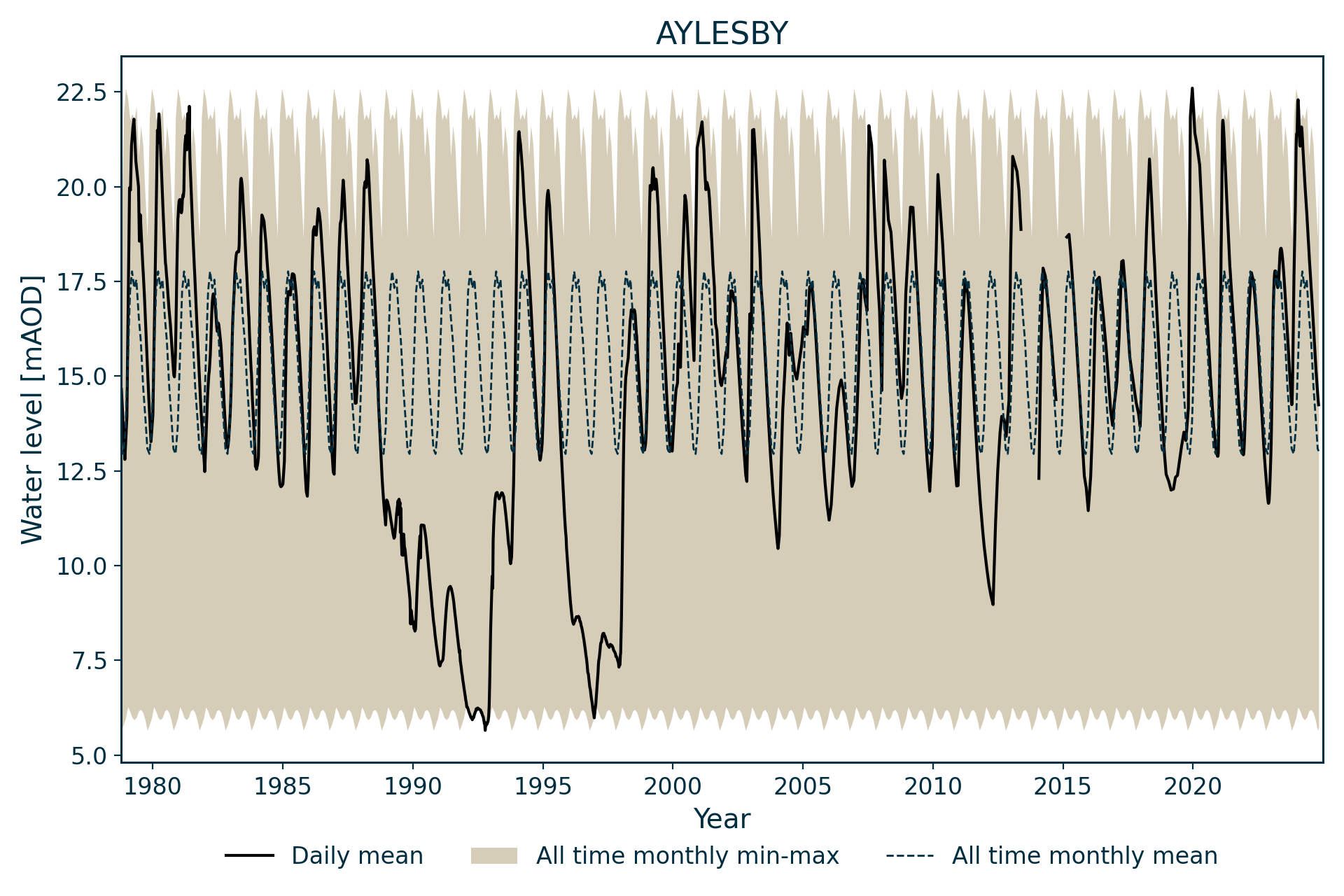
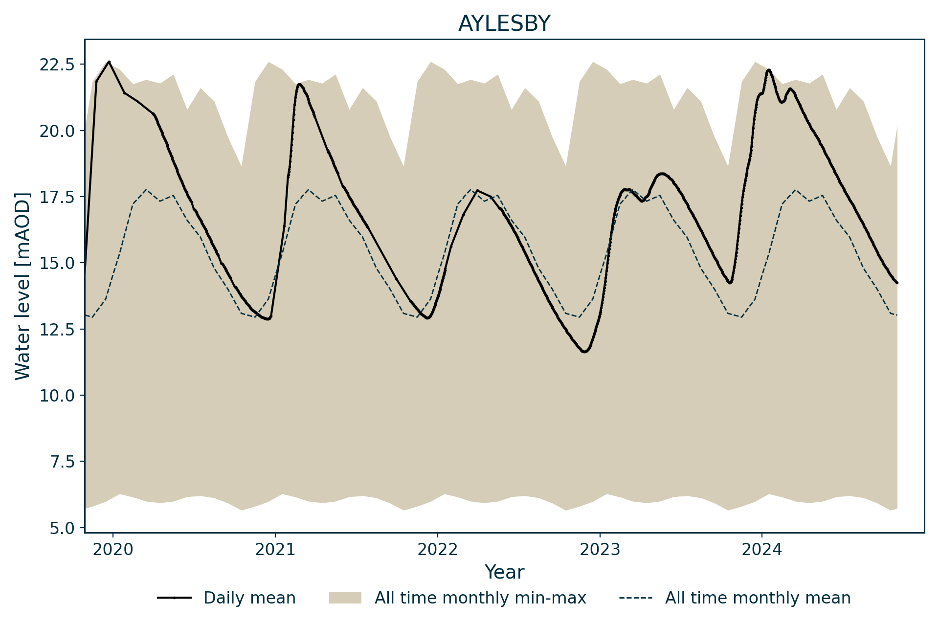
Hydrograph
The groundwater level records for Aylesby start in 1978.
Information about the well
Hydrogeological setting
| Aylesby | |
|---|---|
| Wellmaster ID | TA10/63 |
| NGR | 5194 4071 |
| Datum | 31.25 m AOD |
| Monitoring details | |
| Type | Groundwater level |
| Aquifer | Chalk |
| Confinement | Unconfined |
| Depth | 101.47 m |
| Record | |
| Monitored by | EA Anglian |
| Records commence | 1978 |
| Records end | Active |
This borehole measures water level in the Chalk Group. It is drilled through 26 m of glacial till deposits into the Burnham Chalk Formation.


Geological map of the area around Aylesby. BGS © UKRI.
Well or borehole construction
The borehole was drilled as an observation well and consists of a 152 mm-diameter, PVC-lined borehole to 24.0 m and a 110 mm-diameter hole to 101.47 m.
Hydrograph response
This hydrograph has an annual sinusoidal pattern, with only a minor direct response to winter rainfall episodes. The annual variation is normally between 7 and 10 m, with levels fluctuating around 17 m AOD.
During the 1990s, levels were distinctly lower in the early and late parts of the decade. This may reflect pumping during this period.
Data issues
Aylesby was adopted as an index well to replace Keelby Grange (TA11/158). Keelby Grange exhibited an almost identical response apart from a slightly more pronounced peak at the highest levels and a greater influence from the presumed pumping in the 1990s.
The borehole has been telemetered by the Environment Agency since 1997, with supplementary manual dips.
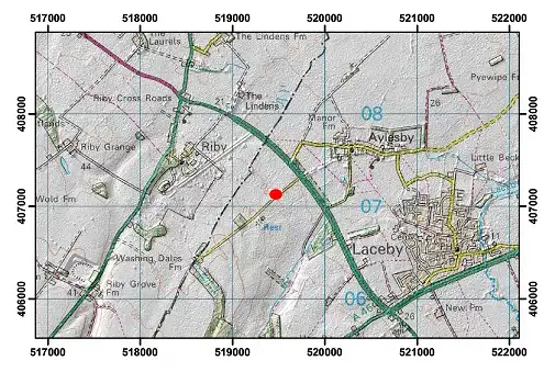
Topographical map with hillshade of the area around Aylesby. BGS © UKRI.
Acknowledgements
Groundwater level data are provided to the NGLA by the Environment Agency (EA), Natural Resources Wales – Cyfoeth Naturiol Cymru (NRW), the Scottish Environment Protection Agency (SEPA) and, for Northern Ireland, the Department for Infrastructure – Rivers and the Northern Ireland Environment Agency.
Further information about these monitoring networks can be found on these pages:
Contact
Please contact BGS Enquiries for further information.