
The borehole at Ampney Crucis in the southern Cotswolds measures water levels in the Jurassic-aged Forest Marble Formation.
BGS Enquiries can help you to access data from the National Groundwater Level Archive (NGLA) for this well
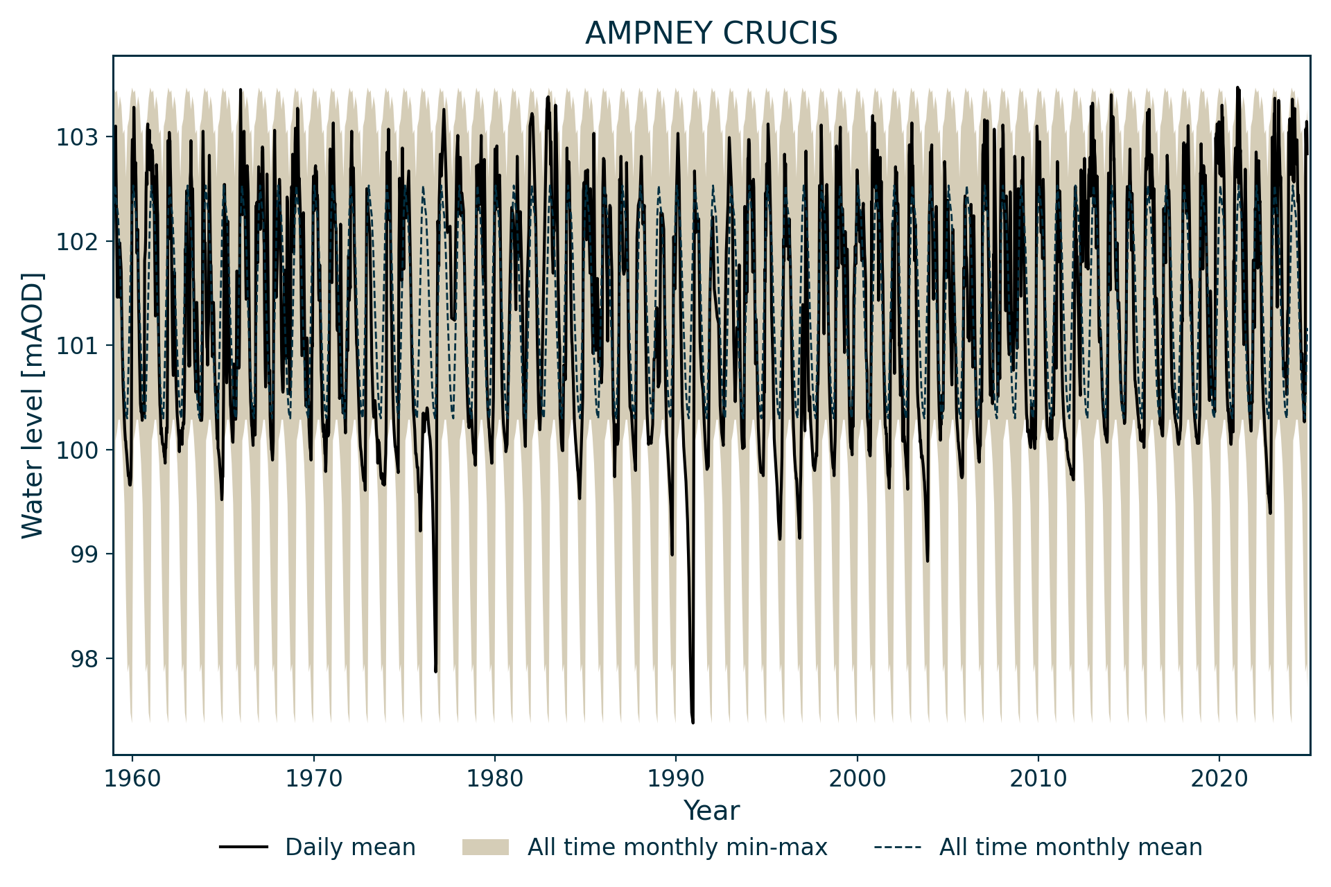
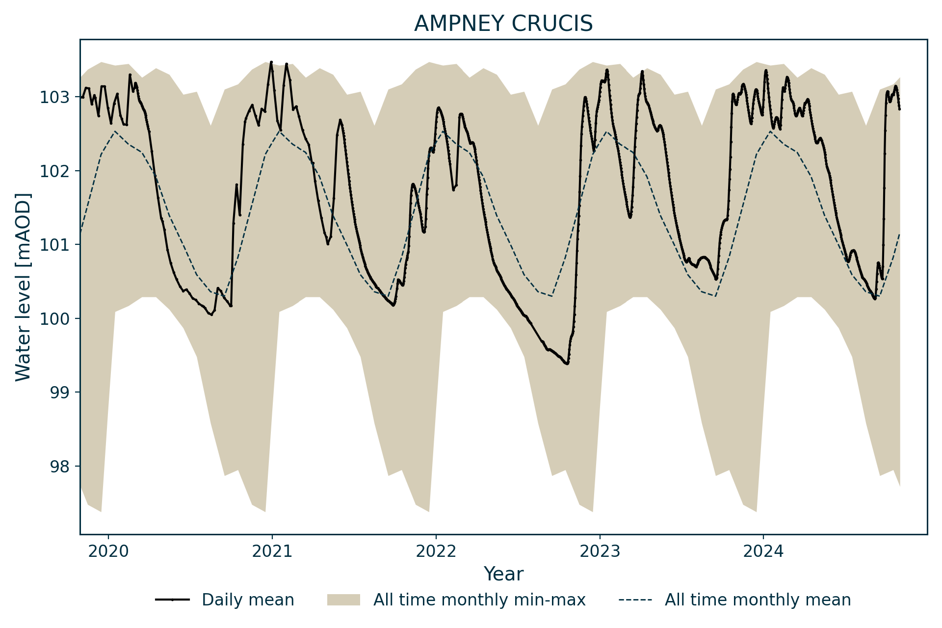
Hydrograph
Information about the well
Hydrogeological setting
| Ampney Crucis | |
|---|---|
| Wellmaster ID | SP00/62 |
| NGR | 4059 2019 |
| Datum | 109.52 m AOD |
| Monitoring details | |
| Type | Groundwater level |
| Aquifer | Jurassic limestone |
| Confinement | Unconfined |
| Depth | 61 m |
| Record | |
| Monitored by | EA Thames |
| Records commence | 1959 |
| Records end | Active |
The borehole measures water level in the Jurassic limestones of the Southern Cotswolds. The local geology is Forest Marble Formation over the Great Oolite Group, penetrating into Fuller’s Earth Formation.
Water levels generally rest within the Forest Marble Formation and are unconfined.
Well or borehole construction
The well was drilled at a diameter of 381 mm, reducing to 254 mm with depth. The top 13.71 m are lined with 254 mm-diameter casing.
Hydrograph response
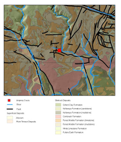

Map of Ampney Crucis showing geology. BGS © UKRI.
The hydrograph has an annual sinusoidal response, with multiple peaks in response to rainfall events during the winter. It is responsive to intense summer rainfall events and frequently shows its maxima in late spring.
Fluctuations are normally around 3 m per annum. A ceiling at just over 103 m AOD may be related to local springs. Water level normally does not drop much below 99 m, except in exceptional droughts, for instance during 1976 and 1990.
Data issues
Institute of Geological Sciences (now BGS) records suggest that manual readings were taken in 1957 and 1958, but these have not been found.
No data for September 1980, October 1980, August 1982 and November 1982 due to failure of chart recorder.
References
Finch, J, Marsh, T, and McKenzie, A A. 2007. A preliminary risk assessment of the potential for groundwater flooding during the winter of 2007/8 — an update. (Wallingford, UK: NERC/Centre for Ecology and Hydrology-British Geological Survey.)
Acknowledgements
Groundwater level data are provided to the NGLA by the Environment Agency (EA), Natural Resources Wales – Cyfoeth Naturiol Cymru (NRW), the Scottish Environment Protection Agency (SEPA) and, for Northern Ireland, the Department for Infrastructure – Rivers and the Northern Ireland Environment Agency.
Further information about these monitoring networks can be found on these pages:
Contact
Please contact BGS Enquiries for further information.