
In Cumbria and Northumberland, 16 sites have been sampled for methane (CH4) in a number of different aquifers. The two main aquifers are Permo–Triassic sandstone and the Fell Sandstone Formation and Border Group.
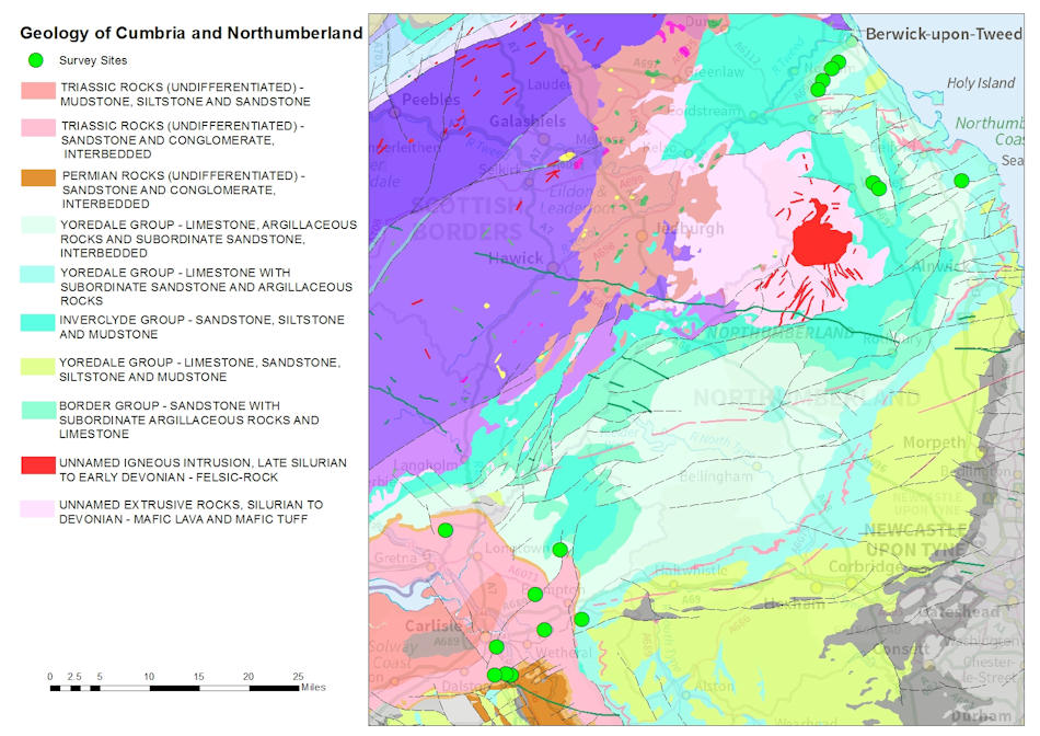

Geology of Cumbria and Northumberland. Contains Ordnance Survey data © Crown copyright and database rights 2014. BGS © UKRI.
Permo–Triassic sandstone
Permo–Triassic sandstone is the second most important aquifer in the UK. It has a high porosity, meaning groundwater flows through pore spaces in the rock. The majority of the Carlisle Basin is Triassic sandstone; this can be up to 600 m thick and is made up of sandstone, conglomerates and marls. The southern part of the Carlisle Basin is Permian sandstone, consisting of sandstone, marls and breccias.
Fell Sandstone Formation and Border Group
The Fell Sandstone and Border Group is an important aquifer for the very north-east of England, stretching west to Carlisle where it reaches great depths. It can be up to 300 m thick and is made of quartz-rich sandstones with silty or pebbly bands.
Shale units
The shale units present in the Northumberland Trough are the Bowland Shale Formation and other black shales of Viséan to Tournaisian age that are typically interbedded with sandstone, siltstone and mudstone. These shales are thinner, shallower and not laterally extensive when compared to the same formation in Lancashire and Yorkshire. Oil shale is present in the Tweed Basin, but at shallow depths.
In the west of this region, the coal seams of the Pennine Coal Measures Group are reported to have potential for coal-bed CH4.
Results
These summary results are from single sampling visits to each site as part of the CH4 baseline project. The data is summarised for the Cumbria and Northumberland region as a whole and for individual aquifers, where enough data is available.
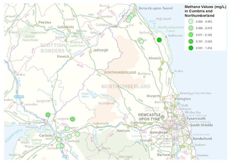
CH4 samples and concentrations in Cumbria and Northumberland. Contains Ordnance Survey data © Crown copyright and database rights 2014. BGS © UKRI.
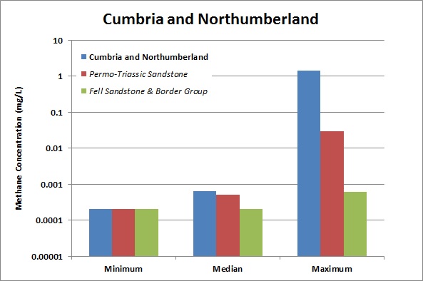
CH4 concentrations chart for Cumbria and Northumberland. BGS © UKRI.
| Area | Concentration | (mg/l) | No. samples | |
|---|---|---|---|---|
| Minimum | Median | Maximum | ||
| Cumbria and Northumberland | 0.0002 | 0.00065 | 1.434 | 16 |
| Permo–Triassic sandstone | 0.0002 | 0.0005 | 0.0296 | 7 |
| Fell Sandstone and Border Group | 0.0002 | 0.0002 | 0.0006 | 3 |
CH4 samples and concentrations in Cumbria and Northumberland. Note: values less than the analytical detection limit have been converted to half the detection limit for the purposes of this statistical summary and graph, but the relevant detection limit is quoted in the table.
Baseline groundwater quality data
There is no baseline data available for Permo–Triassic sandstone or the Fell Sandstone and Border Group in this region.