
In South Wales, 25 sites were sampled for methane in the two main aquifers, the Carboniferous limestone and the Coal Measures sandstones.
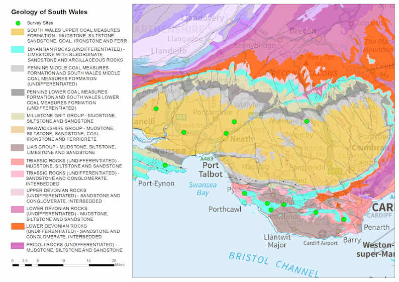

Geology of South Wales. Contains Ordnance Survey data © Crown copyright and database rights 2015. BGS © UKRI.
Carboniferous limestone
In the UK, Carboniferous limestone is a principal aquifer and groundwater flows rapidly through a network of fractures, conduits and caves. In South Wales, this aquifer is not used for public supply, although it provides many private supplies. The Carboniferous limestone crops out south of the South Wales coalfield and has a maximum thickness of 425 m.
Coal Measures sandstones
The Coal Measures sandstones in South Wales are very hard and dense, and groundwater will only tend to flow through fractures. Due to mining subsidence, there are zones of increased fracturing, therefore increased water storage and flow. This aquifer is classed as a secondary A aquifer by the Environment Agency and is not used for public water supply.
Shale units
The shale unit present in this area is the Marros Group, which consists of siliceous mudstones and local quartz rich sandstones and conglomerates. The maximum height of the top of the Marros Group is about 400 m above OD at outcrop in the west, but deepens towards the east to reach depths of over 2500 m below OD.
Results
These summary results are from single sampling visits to each site as part of the methane baseline project. The data is summarised for the South Wales region as a whole and for individual aquifers, where enough data is available.
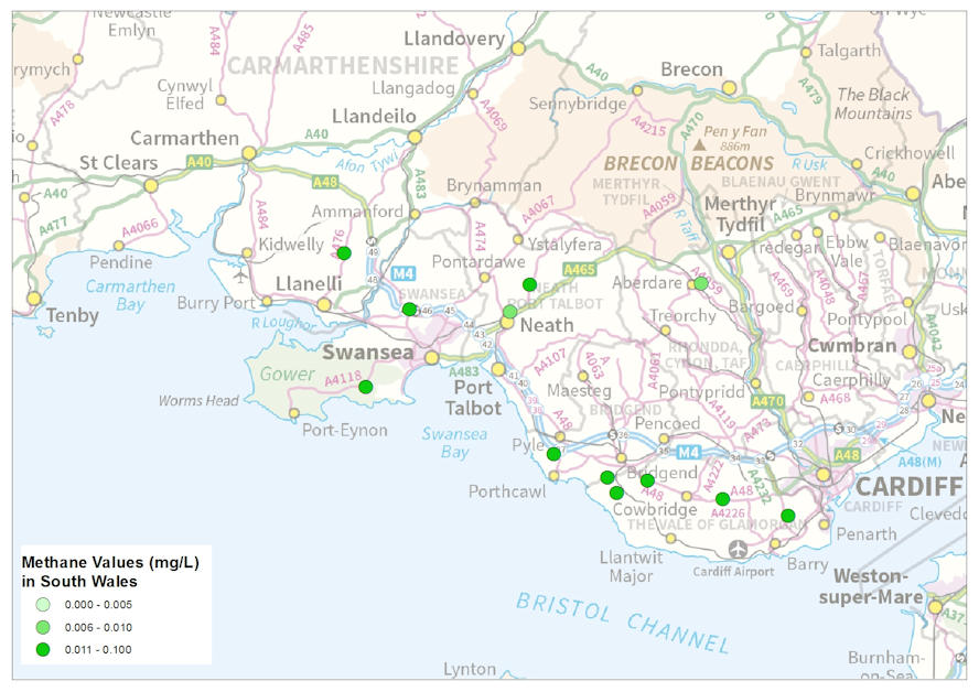
Methane samples and concentrations in South Wales. Contains Ordnance Survey data © Crown copyright and database rights 2015. BGS © UKRI.
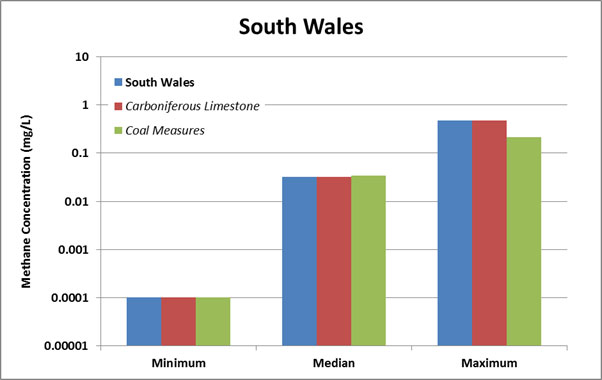
Methane concentrations bar chart for South Wales. BGS © UKRI.
| Area | Concentration | (mg/l) | No. Samples | |
|---|---|---|---|---|
| Minimum | Median | Maximum | ||
| South Wales | <0.0001 | 0.032 | 0.483 | 25 |
| Carboniferous limestone | <0.0001 | 0.032 | 0.483 | 11 |
| Coal Measures sandstones | <0.0001 | 0.034 | 0.216 | 13 |
Methane samples and concentrations in South Wales. Note: values less than the analytical detection limit have been converted to half the detection limit for the purposes of this statistical summary and graph, but the relevant detection limit is quoted in the table.
Baseline groundwater quality data
There is no baseline data available for the Carboniferous limestone or the Coal Measures sandstones in this region.