Baseline Scotland was a joint project between BGS and the Scottish Environment Protection Agency (SEPA), which provided new groundwater chemistry data for Scotland. The data provided essential information to sustainably manage Scotland’s water environment, such as the Water Framework Directive. Before Baseline Scotland, very little reliable groundwater chemistry data existed, particularly for trace elements.
Systematic groundwater sampling surveys were carried out across all the major bedrock aquifers, as well as many superficial aquifers, in Scotland between 2005 and 2011. Standardised sampling techniques were used to characterise the groundwater chemistry in detail and investigate:
- how long it had been since groundwater was recharged from rainfall
- how groundwater has interacted with the aquifer rocks
- whether there was any groundwater pollution
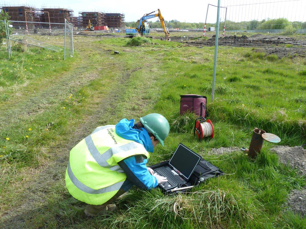

Monitoring shallow groundwater in Glasgow. BGS © UKRI.
Baseline Scotland report series
The aims of Baseline Scotland were to provide a scientific foundation to Scottish, UK and European water quality policy and groundwater management and protection and to characterise the natural background groundwater quality in the main aquifers of Scotland. There was an emphasis on the protection and sustainable development of high quality groundwater.
Spatial coverage
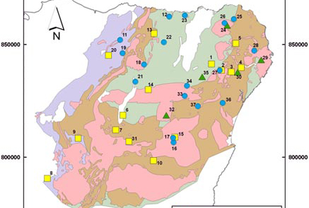
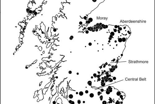
Before the Baseline Scotland project began there was little information on natural groundwater chemistry in Scotland. Existing data was mainly old, of variable quality and limited, often to a few major ions only. The data was also skewed to areas of groundwater contamination, particularly related to mining, and to the more productive Scottish aquifers, in particular the Devonian aquifers of Fife, Strathmore and Morayshire, and the Permian aquifer in Dumfries.
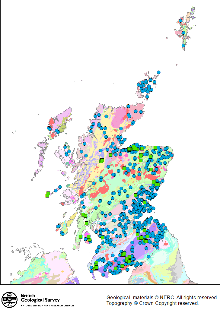
Spatial coverage of Baseline Scotland groundwater chemistry data for bedrock aquifers (blue circles) and Quaternary aquifers (green squares). Backdrop is 1:625 000 scale geological map. BGS © UKRI.
Twelve major bedrock aquifer units were defined across Scotland, which have distinctly different controls on baseline groundwater chemistry (largely related to geological age and rock type). The baseline groundwater chemistry of each of these aquifer units is reported separately.
A summary of the baseline groundwater chemistry in each major bedrock aquifer in Scotland is presented in Scotland’s aquifers and groundwater bodies.
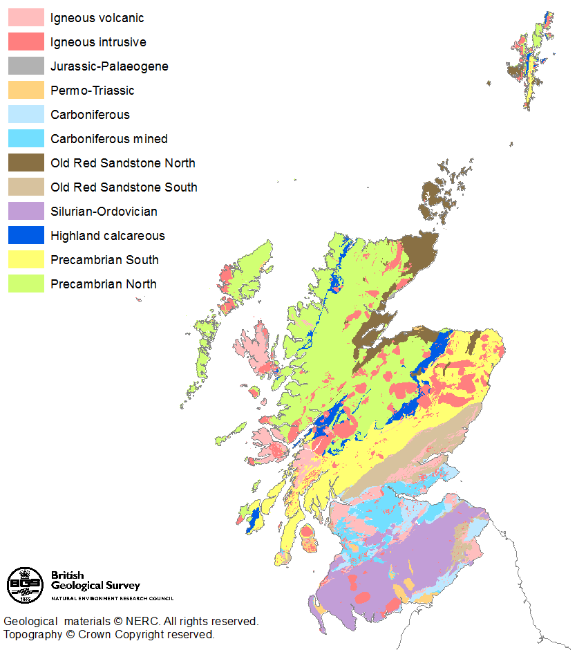
Major bedrock aquifer units in Scotland, which show distinctly different baseline groundwater chemistry. BGS © UKRI.