
Heathlanes is a well originally sunk for private water supply; it is now used to monitor the Permo–Triassic sandstone aquifer in Shropshire. It is one of the wells used to monitor the Shropshire Groundwater Scheme, which uses groundwater to maintain flows in the River Severn during droughts.
BGS Enquiries can help you to access data from the National Groundwater Level Archive (NGLA) for this well.
Hydrograph
Information about the well
Hydrogeological setting
| Heathlanes | |
|---|---|
| Wellmaster ID | SJ62/112 |
| NGR | 3619 3210 |
| Datum | 68.61 m AOD |
| Monitoring details | |
| Type | Groundwater level |
| Aquifer | Permo–Triassic sandstone |
| Confinement | Unconfined |
| Depth | 8.74 m |
| Record | |
| Monitored by | EA Midlands |
| Records commence | 1971 |
| Records end | Active |
This well monitors a Permo–Triassic sandstone aquifer in Shropshire. It is dug into the Bridgnorth Sandstone Formation, overlain by till deposits. A detailed borehole log is not available.
Well or borehole construction
Originally constructed for domestic supply, it is a 1 m-diameter well that is stone lined.
Hydrograph response
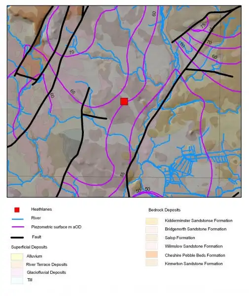

Map of Heathlanes showing geology and water level contours. BGS © UKRI.
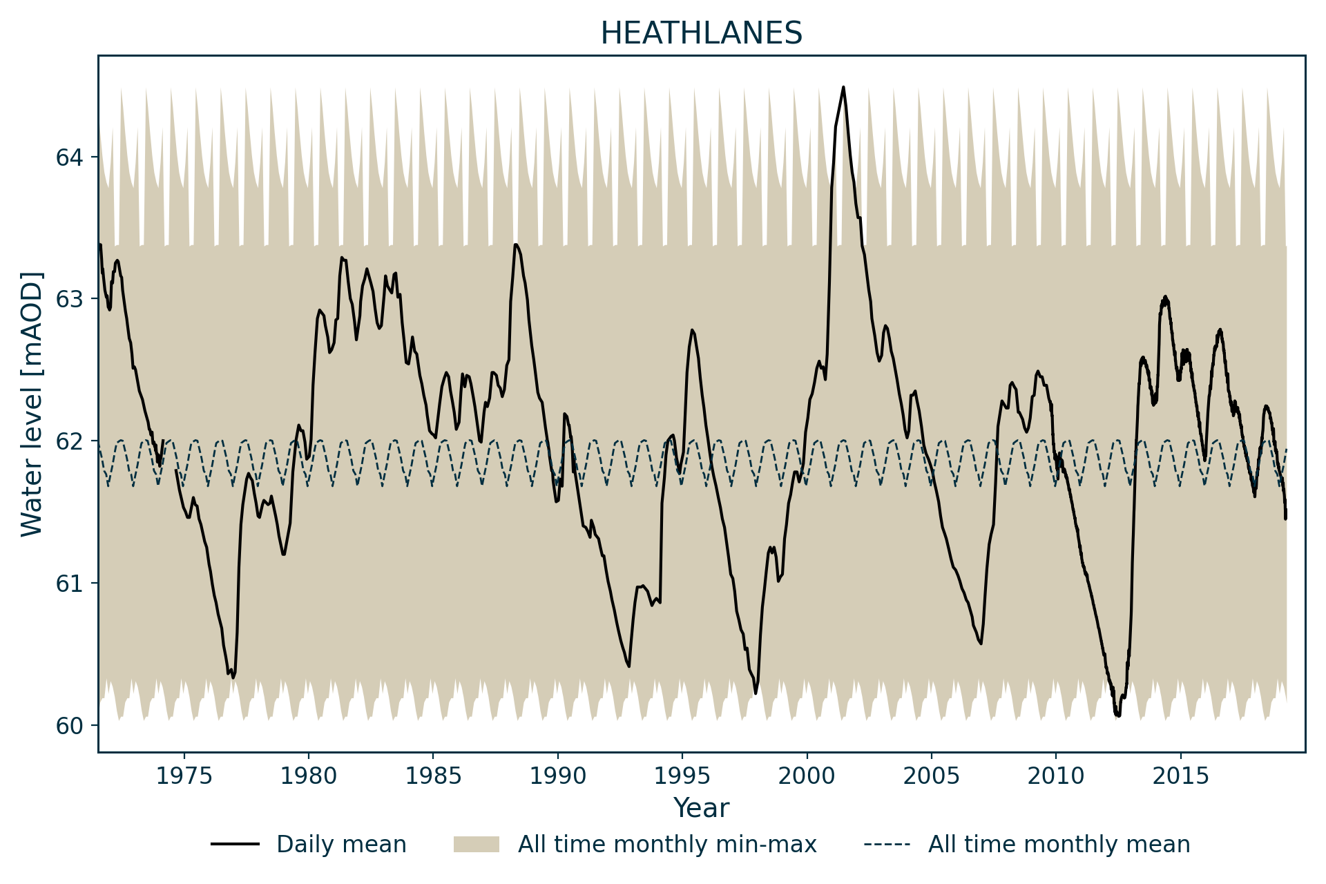
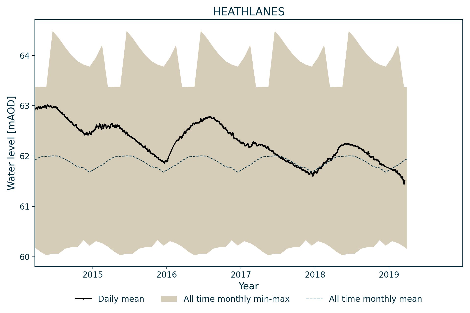
The hydrograph shows a groundwater system responsive to both seasonal recharge and longer-term aquifer scale fluctuations. Seasonal fluctuations are normally less than 0.5 m amplitude, with long-term variation around 3 m amplitude. The seasonal fluctuations are seen most clearly when levels are close to the long-term mean, 62 m AOD. At lower and higher levels, the seasonal response appears damped. The lowest water levels are close to the bottom of the well.
Data issues
There is some data missing for 2001, when access to the well was limited by the foot-and-mouth disease outbreak.
Acknowledgements
Groundwater level data are provided to the NGLA by the Environment Agency (EA), Natural Resources Wales – Cyfoeth Naturiol Cymru (NRW), the Scottish Environment Protection Agency (SEPA) and, for Northern Ireland, the Department for Infrastructure – Rivers and the Northern Ireland Environment Agency.
Further information about these monitoring networks can be found on these pages:
Contact
Please contact BGS Enquiries for further information.