
The borehole at Alstonefield in the Peak District measures water level in the Carboniferous-aged Hopedale Limestone Formation. Our records date back to 1974.
BGS Enquiries can help you to access data from the National Groundwater Level Archive (NGLA) for this well.
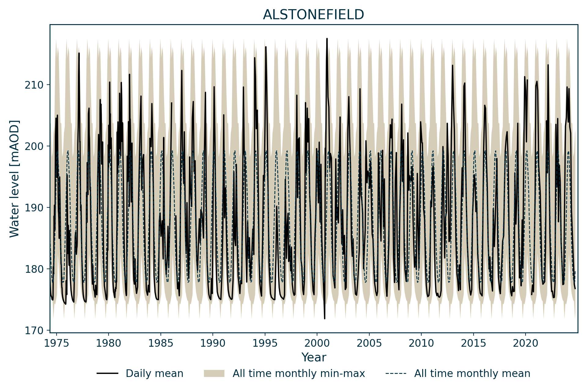
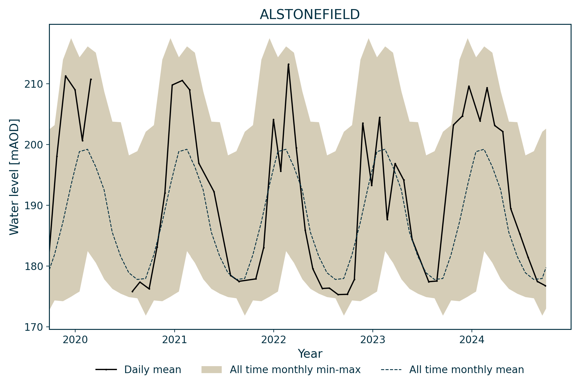
Hydrograph
Information about the well
Hydrogeological setting
| Alstonefield | |
|---|---|
| Wellmaster ID | SK15/16 |
| NGR | 4129 1554 |
| Datum | 280.25 m AOD |
| Monitoring details | |
| Type | Groundwater level |
| Aquifer | Carboniferous limestone |
| Confinement | Unconfined |
| Depth | 137.2 m |
| Record | |
| Monitored by | EA Midlands |
| Records commence | 1974 |
| Records end | Active |
The borehole is drilled into the Hopedale Limestone Formation of the Peak Limestone Group. A north–south trending fault mapped immediately to the east of the site upthrows the Woo Dale Limestone Formation.
The relatively deep water level in the borehole reflects a regional water level controlled by drainage in the incised valley of the River Dove to the south of the borehole.
Although not noted in the borehole log, the village of Alstonefield had several low-yielding, shallow wells that may have tapped perched aquifers.
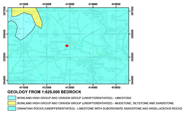

Geological map of the area around Alstonefield. BGS © UKRI.
Well or borehole construction
The well consists of a 178 mm-diameter borehole drilled to 121.92 m. The diameter reduces to 140 mm from 121.92 m to 137.3 m.
Hydrograph response
The well hydrograph shows an open groundwater system that is very responsive to seasonal recharge. As might be expected from a limestone aquifer, responses to rainfall can be rapid and peaky, responding to individual rainfall episodes through the winter.
Data issues
Weekly data until 1983, then monthly data.
Reference
Finch, J, Marsh, T, and McKenzie, A A. 2007. A preliminary risk assessment of the potential for groundwater flooding during the winter of 2007/8 — an update. (Wallingford, UK: NERC/Centre for Ecology and Hydrology-British Geological Survey.)

Topographical map with hillshade of the area around Alstonefield. BGS © UKRI.
Acknowledgements
Groundwater level data are provided to the NGLA by the Environment Agency (EA), Natural Resources Wales – Cyfoeth Naturiol Cymru (NRW), the Scottish Environment Protection Agency (SEPA) and, for Northern Ireland, the Department for Infrastructure – Rivers and the Northern Ireland Environment Agency.
Further information about these monitoring networks can be found on these pages:
Contact
Please contact BGS Enquiries for further information.