Geological Survey of England and Wales
In 1832 Henry De la Beche was appointed by the Board of Ordnance 'to affix geological colours to maps of Devonshire, with portions of Somerset, Dorset and Cornwall' and so the Survey was born. By the end of 1834 seven sheets were completed and after consultation the Treasury funded the Ordnance Geological Survey, then part of the Ordnance Survey.
The mapping of this area proceeded and by 1839 fourteen sheets had been published and De La Beche published the first 'Memoir', the 'Report on the Geology of Cornwall, Devon, and West Somerset'.
In 1844, an innovation by William Edmond Logan was the creation and publishing of the horizontal and vertical sections. These were meticulously surveyed on a scale of six inches to a mile while the vertical sections were usually at a scale of one inch to forty feet.
By 1845, nearly the whole of Somerset, the western half of Gloucestershire, the counties of Monmouth, Glamorgan, Carmarthen, and Pembroke and nearly the whole of Brecknock and Herefordshire, together with part of Worcestershire had been mapped and published and by 1854 the whole of Wales had been completed.
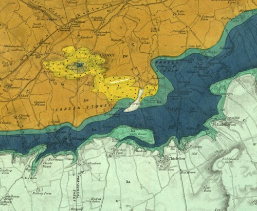
Six-inch to the mile scale and superficial deposits
Mapping was still undertaken on the scale of one-inch to one mile maps but following the example in Ireland, the new mapping of the northern counties was done on the six-inch to the mile scale field sheets.
Another innovation was recognising the importance of the superficial deposits, in most cases, the sands, gravels and boulder clays deposited during the Glacial period. Mapping of these began at about the same time.
Expansion and a recruitment drive for geologists
After a Royal Commission on Coal in 1866 the Geological Survey greatly expanded under Roderick Impey Murchison and 21 field geologists were recruited during 1868-1869.
By this time the survey had progressed northwards and eastwards to a line from Liverpool to Selby and as far east as Retford, Melton Mowbray, Market Harborough, Huntingdon, London, Chatham and Folkestone and parts further north of Lancashire, Westmoreland and some of the Northumberland Coalfield.
Mapping stops in the 1880s!
During the 1880s there was a (short-lived) cessation of mapping at six-inches to the mile with the aim of pushing the completion of the primary mapping of England and Wales, the latter being completed in 1883. Staff were then transferred to Scotland, or to map the Drift of the southern counties that was missed during the early surveys. Sheets continued to be produced in hand coloured form up to 1903.
Eventually, the typically colour printed 'New Series' one-inch geological maps superseded the older hand-coloured maps. For much of central and southern England and Wales the New Series was on new sheet lines with different sheet numbering. In northern England the older hand coloured maps and New Series sheet lines coincided, though the sheet numbering was different.
Bibliography
Bailey, E B. 1952. Geological Survey of Great Britain. (London: Murby.)
Flett, J S. 1937. The first hundred years of the Geological Survey of Great Britain. (London: HMSO.)
McIntosh, R P. 2012. Geological Survey of Great Britain and Ireland - a contemporary account of the Survey, 1897 (3.17 MB pdf). Extract and illustrated from 1897 Geological Survey of Great Britain. Summary of Progress (unpublished).
McKenna, G. (Ed) [Unpublished manuscript]. Instructions for the Local Directors of the Geological Survey of Great Britain and Ireland (330 KB pdf) by Henry De la Beche 22nd May 1845. Selected documents from the BGS Archives No. 1
Wilson, Harry. 1985. Down to earth: one hundred and fifty years of the British Geological Survey. (Edinburgh: Scottish Academic press.)
