
BGS and the Environment Agency (EA) developed a method of assessing the vulnerability of groundwater from onshore oil and gas extraction activities in England. This tool improved our understanding of the risk to groundwater.
The UK oil and gas industry is one of the most regulated in the world, so risks to groundwater are already covered in UK law. This new vulnerability assessment helped to ensure that the UK continues to put safety first when investigating new energy sources.
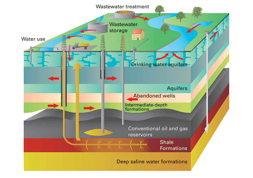

Potential risk of groundwater being contaminated from leaks from oil and gas wells, through old infrastructure (mines and boreholes) and by transport through the rock mass from the source of the oil and gas. Schematic diagram, not to scale. BGS © UKRI.
Research and development
BGS conducted a study to develop an accessible and nationally consistent method for assessing the vulnerability of groundwater to potential contamination from any possible future activities deeper in the subsurface. The method is based on well-established approaches already employed by the EA as part of the environmental regulation and permitting process.
The method uses BGS’s 3D geological model of England to show the locations of aquifers and rocks that could contain oil and gas. This allows identification of the key parts of the underground water system that might be affected by future hydrocarbon extraction. A tool developed to guide the assessment considers the following elements:
- classification of the groundwater: is it an aquifer? How is it used?
- hydrocarbon extraction types: is there hydraulic fracturing?
- groundwater flow direction: is it towards or away from the hydrocarbon source?
- groundwater vulnerability: are there any underground sources of pollution derived from underground oil and gas activities?
The last includes factors such as:
- the distance between the potential hydrocarbon source and the aquifer
- the thickness of low-permeability rocks
- potential pathways for pollution such as geological faults, boreholes and mines
Based on these considerations, an overall risk group can be identified, as can the degree of certainty in this grouping.
Case studies and trials
The method was trialled on five case study sites across England addressing different extraction activities:
- conventional oil and gas in south-east England
- coal-bed methane in the East and West Midlands
- shale gas in north-west England
- shale gas and conventional oil and gas in north-east England
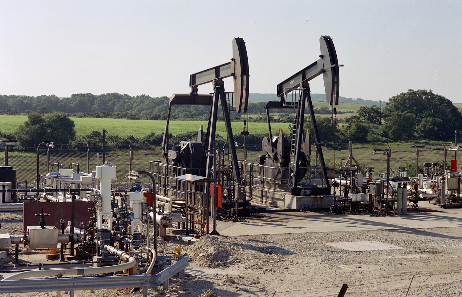
Nodding donkeys at Wytch Farm D site, Dorset, England. BGS © UKRI.
Most aquifers were rated as being at low risk from contamination. There were occasional instances of medium to low risk ratings for important aquifers with a smaller separation from the oil and gas sources. Medium and high risk groups occurred rarely, where important aquifers overlie shale gas and coal-bed methane activities. There were no potential receptors in the high risk group in the case studies.
Report
These initial findings are now available and we would welcome views on how to develop the methodology further: 3D groundwater vulnerability.
Contact
Please contact BGS Enquiries (enquiries@bgs.ac.uk) for more information.