
This well is used to monitor water levels in the confined Jurassic-aged Inferior Oolite Group aquifer to the west of Malmesbury, Gloucestershire, England.
BGS Enquiries can help you to access data from the National Groundwater Level Archive (NGLA) for this well.
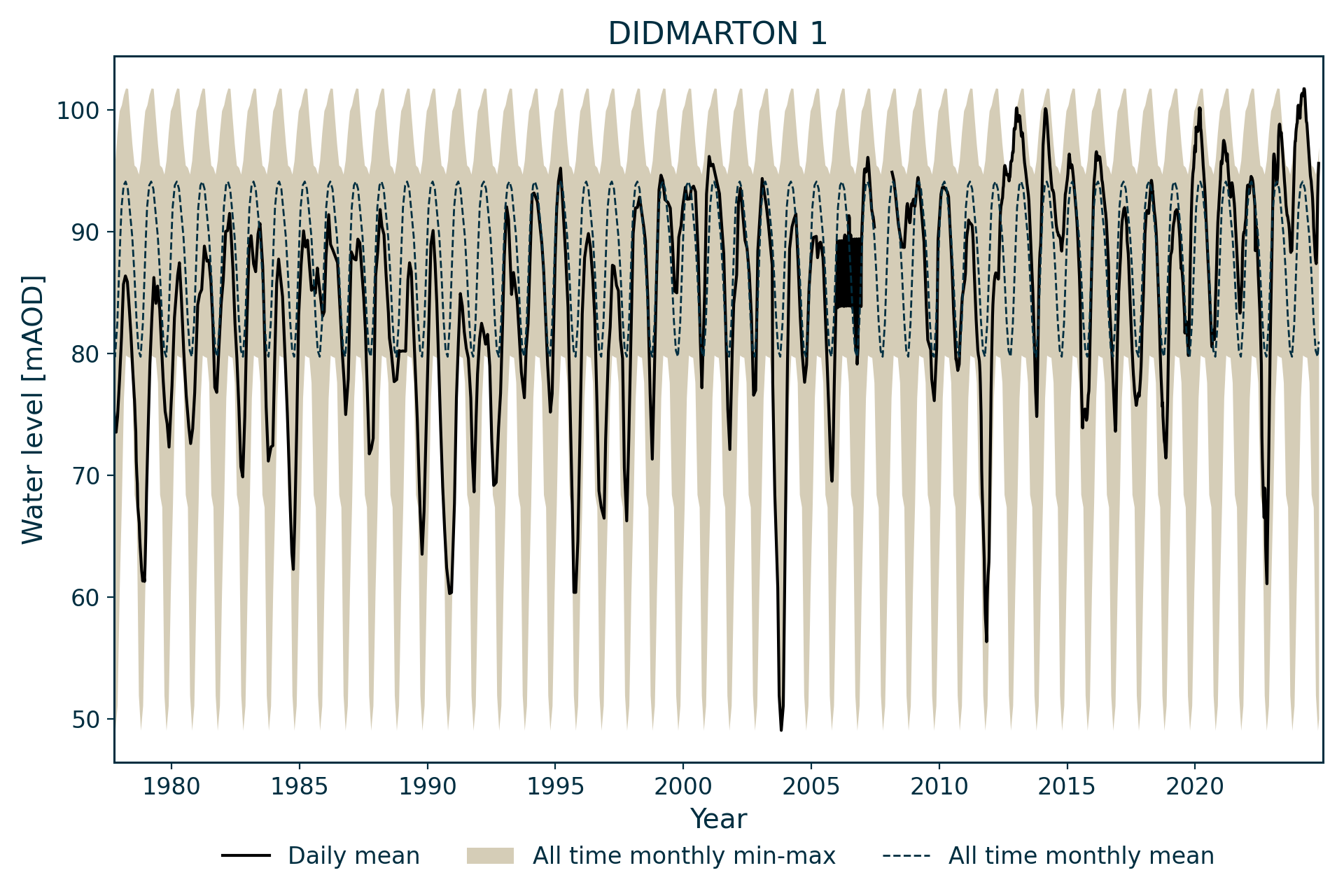
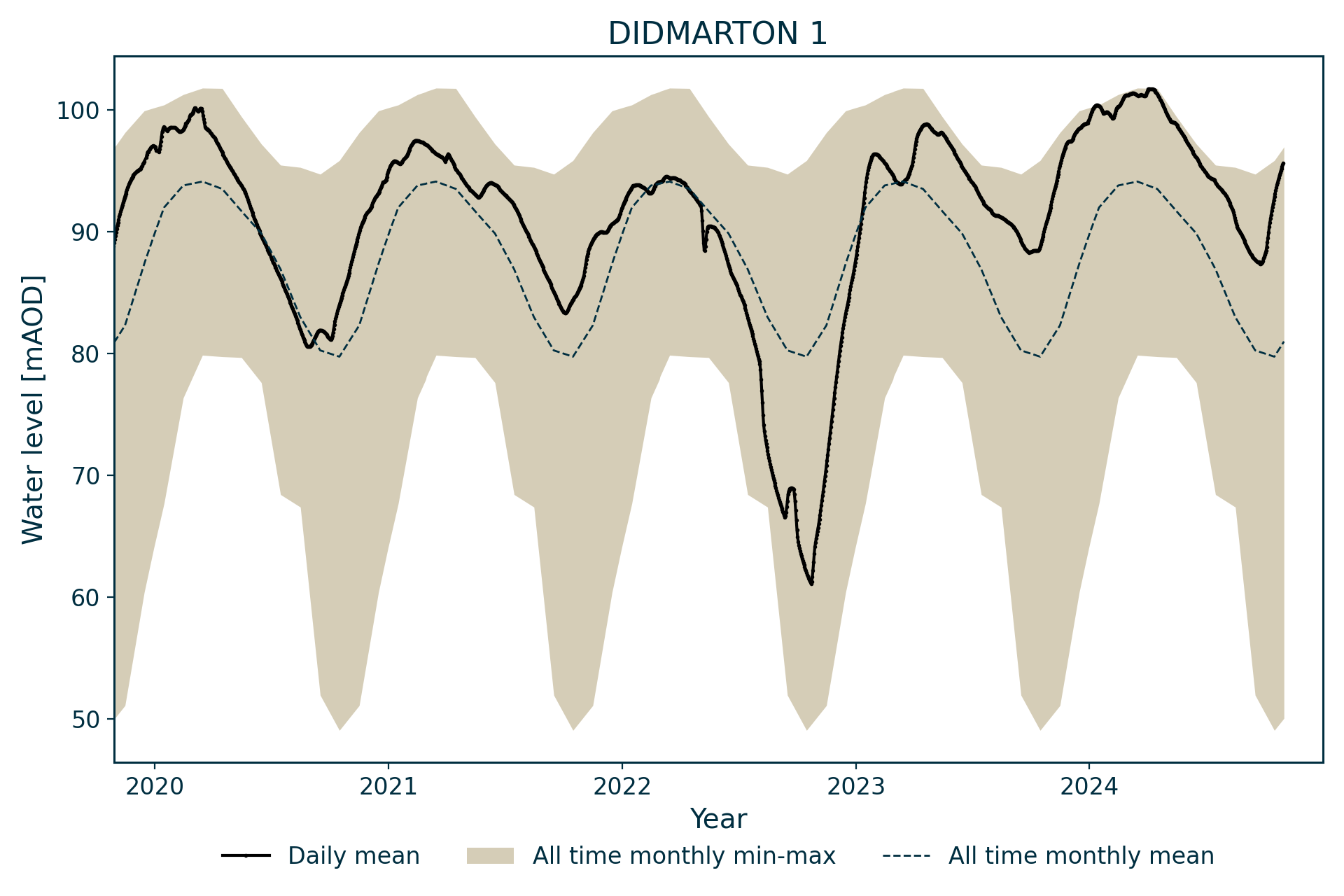
Hydrograph
Information about the well
Hydrogeological setting
| Didmarton 1 | |
|---|---|
| Wellmaster ID | ST88/62A |
| NGR | 3827 1874 |
| Datum | 113.8 m AOD |
| Monitoring details | |
| Type | Groundwater level |
| Aquifer | Jurassic limestone |
| Confinement | Confined |
| Depth | 112.1 m |
| Record | |
| Monitored by | EA South East |
| Records commence | 1977 |
| Records end | Active |
The borehole is located near the outcrop of the junction of the Forest Marble Formation and the Chalfield Oolite Formation, both part of the overlying Great Oolite Group aquifer. Beneath this, the borehole penetrates the Fuller’s Earth Formation, the Inferior Oolite Group and about 5.5 m of the Bridport Sand Formation.
The Inferior Oolite aquifer is confined by clays within the Fuller’s Earth Formation. The underlying Bridport Sand Formation has a high storage coefficient and is generally in hydraulic continuity with the Inferior Oolite Group limestones.
Well or borehole construction
The borehole has a diameter of 101 mm to 85 m depth, below which it narrows to 86 mm. It has 51 mm casing to 80 m depth.
Hydrograph response
The hydrograph shows a smooth sinusoidal pattern. The water level exhibits large seasonal fluctuations but always remains above the base of the confining beds. The maximum water level appears to be constrained.
Acknowledgements
Groundwater level data are provided to the NGLA by the Environment Agency (EA), Natural Resources Wales – Cyfoeth Naturiol Cymru (NRW), the Scottish Environment Protection Agency (SEPA) and, for Northern Ireland, the Department for Infrastructure – Rivers and the Northern Ireland Environment Agency.
Further information about these monitoring networks can be found on these pages:
Contact
Please contact BGS Enquiries for further information.