
The well at Ashton Farm near Dorchester in Dorset measures water levels in the Cretaceous-aged Lewes Nodular Chalk Formation aquifer. The well lies to the south of a north-west to south-east trending fault. Our groundwater level records start in 1974.
BGS Enquiries can help you to access data from the National Groundwater Level Archive (NGLA) for this well.
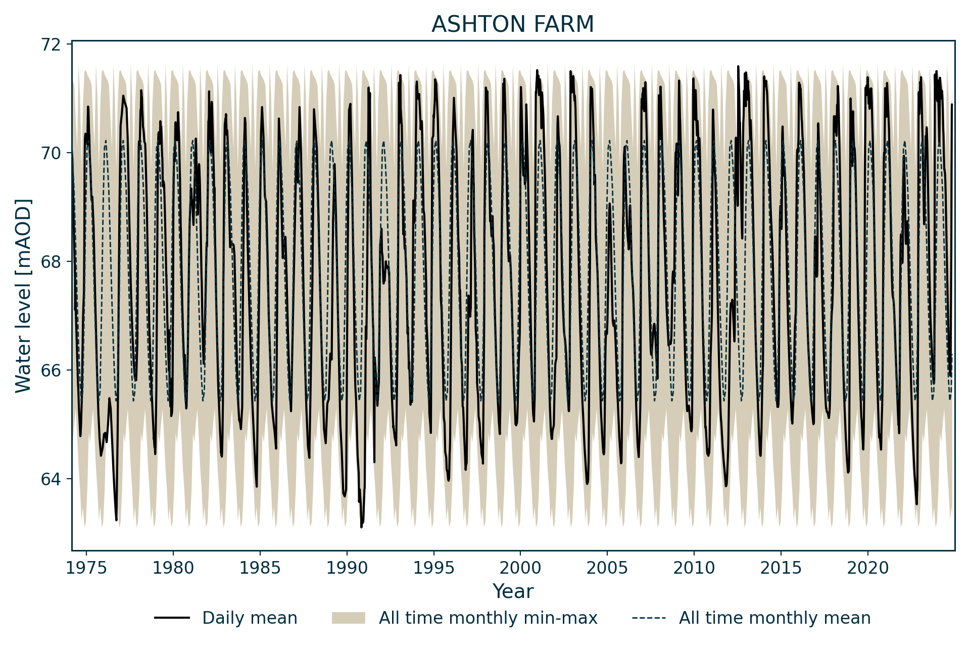
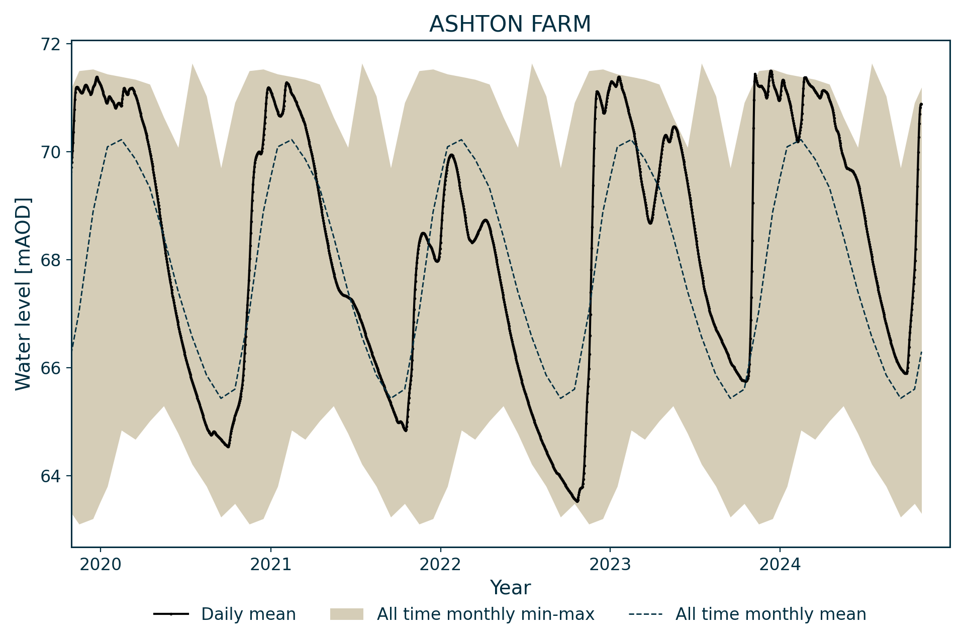
Hydrograph
Information about the well
Hydrogeological setting
| Ashton Farm | |
|---|---|
| Wellmaster ID | SY68/34 |
| NGR | 3661 0880 |
| Datum | 72.16 m AOD |
| Monitoring details | |
| Type | Groundwater level |
| AquiferCC | Chalk |
| Confinement | Unconfined |
| Depth | 11.7 m |
| Record | |
| Monitored by | EA South West |
| Records commence | 1974 |
| Records end | Active |
This well monitors water levels in the Chalk Group of Wessex and is dug into the Lewes Nodular Chalk Formation. The site lies on the south side of the west-north-west to east-south-east trending Winterbourne Abbas Fault with a downthrow to the north-north-east of 20 m.


Geological map of the area around Ashton Farm. BGS © UKRI.
Well or borehole construction
It is a brick-lined well, 1.4 m in diameter. It was originally sunk for a farm water supply.
Hydrograph response
The hydrograph has an annual sinusoidal appearance, with some response to intense winter rainfall events. Its response is rapid for a chalk well, presumably because of its shallow depth. It appears to have an unconstrained response, although levels tend to peak close to 71 m AOD, and have only been lower than 64 m on rare occasions.
References
Finch, J, Marsh, T, and McKenzie, A A. 2007. A preliminary risk assessment of the potential for groundwater flooding during the winter of 2007/8 — an update. (Wallingford, UK: NERC/Centre for Ecology and Hydrology-British Geological Survey.)
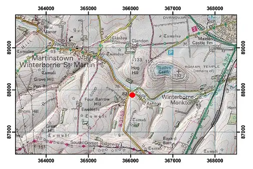
Topographical map with hillshade of the area around Ashton Farm. BGS © UKRI.
Acknowledgements
Groundwater level data are provided to the NGLA by the Environment Agency (EA), Natural Resources Wales – Cyfoeth Naturiol Cymru (NRW), the Scottish Environment Protection Agency (SEPA) and, for Northern Ireland, the Department for Infrastructure – Rivers and the Northern Ireland Environment Agency.
Further information about these monitoring networks can be found on these pages:
Contact
Please contact BGS Enquiries for further information.