On 24 July 2012, the BGS Landslide Response Team received reports of a large rock fall on the Jurassic Coast at Burton Bradstock in Dorset. It was reported that approximately 400 tons of rock fell in two rock-fall events approximately 20 minutes apart at around 12:30.
Tragically, 22-year-old Charlotte Blackman from Derbyshire was killed in the incident. The public have been advised to stay away from the cliffs.
- Have British cliffs become more prone to landslides? The Guardian, 25 July 2012
- Woman feared dead after cliff crashes down to coastal path The Independent, 25 July 2012
- Couple cheat death by seconds as they watch 300 ton cliff landslide just feet away The Daily Mail, 19 February 2012
The BGS Landslide Response Team carried out a survey of the site, including a LiDAR survey, on 25 July 2012. Data collected from this survey is logged in the BGS National Landslide Database NLD 18684/1.

3D image of failed cliff at Burton Bradstock generated from a LiDAR survey undertaken by BGS. BGS © UKRI.
The landslide
The BGS Landslide Response Team carry out a LiDAR survey of the Burton Bradstock rock fall landslide of 24 July 2012.
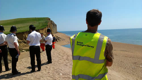
The BGS Landslide Response Team waiting for access to the beach to carry out a survey of the landslide on 25 July 2012. BGS © UKRI.
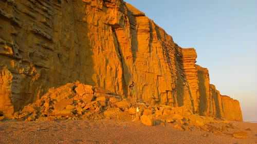
The Burton Bradstock rock fall landslide of 24 July 2012. BGS © UKRI.
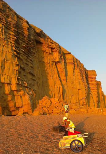
The BGS Landslide Response Team carry out a LiDAR survey of the Burton Bradstock rock fall landslide of 24 July 2012. BGS © UKRI.
The failure was controlled and constrained by a combination of factors:
- discontinuities
- joints and fractures within the cliff run vertically and parallel to the cliff face, enabling wedge-shaped sections of cliff to fall
- coastal erosion and weathering
- coastal erosion and weathering of the cliff face are a continual natural process
- the sea is eroding the base of the cliff (undercutting), removing support for the rocks above
- the processes of weathering weakens the cliff, making it more susceptible to failure
- recent wet weather added more water into the cliff from above, so that grain support was weakened in the Bridport Sand Formation (see Geology section) thereby increasing the likelihood of a landslide occurring
The rock fall deposit was 30 m long, 20 m wide and 10 m high and ran out over a gravel beach.
Geology
The geology of the cliffs at Burton Bradstock comprises the Bridport Sand Formation, overlain by the Inferior Oolite Group, overlain by the Fuller’s Earth Formation.
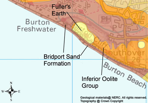
Geology of Burton Bradstock area. BGS © UKRI.
The Bridport Sand Formation at Burton Bradstock showing stronger and weaker beds. BGS © UKRI (taken in 1972).
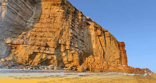
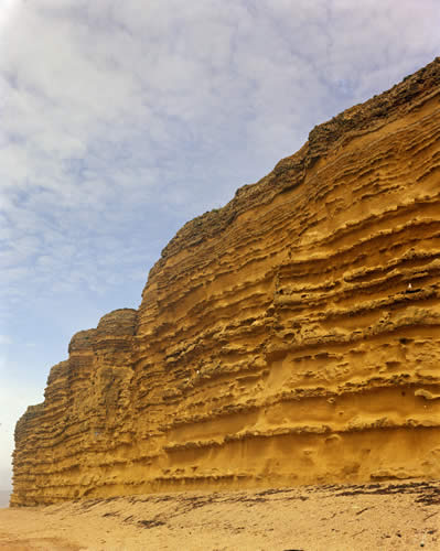
The cliffs at Burton Bradstock mostly comprise the Bridport Sand Formation, a grey, brownish (weathering to a yellow colour), micaceous silt and fine-grained sandstone with stronger sandstone beds occurring irregularly throughout the succession, typically every metre or so. These stronger sandstone beds are more resistant to weathering so protrude from the cliff face.
The Bridport Sand Formation is approximately 180 million years old and is at its thickest in the Burton Bradstock area, forming the 40 m-high cliffs seen at the coast. It is a weak to moderately strong sandstone that becomes weaker when wet. Most of the landslide deposit was composed of this formation, with blocks up to 2 m3 in the landslide debris.
Above the Bridport Sand Formation is a three metre bed of limestone from the Inferior Oolite Group that forms a cap at the top of the cliff. This is a stronger material than the Bridport Sand Formation and, consequently, 2 × 2 × 0.5 m blocks were seen in the landslide debris.
Above the Inferior Oolite Group is a bed of Fuller’s Earth Formation, a calcareous mudstone forming shallow mudflows cascading down parts of the cliff.
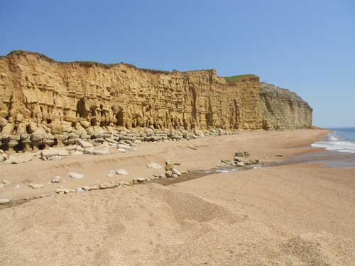
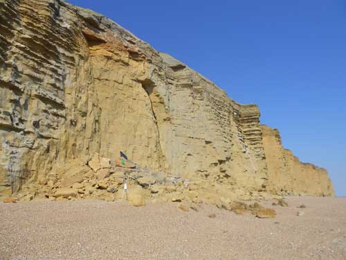
The yellow sandstone cliffs between Freshwater Bay and Hive Beach are shaped by erosion processes, including landslides. BGS © UKRI (taken in 2012).
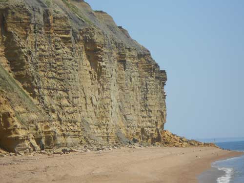
Eroding piles of rock debris along the base of the Jurassic sandstone cliffs at Burton Bradstock are telling signs of continual erosion by landslides. BGS © UKRI (taken in 2012).
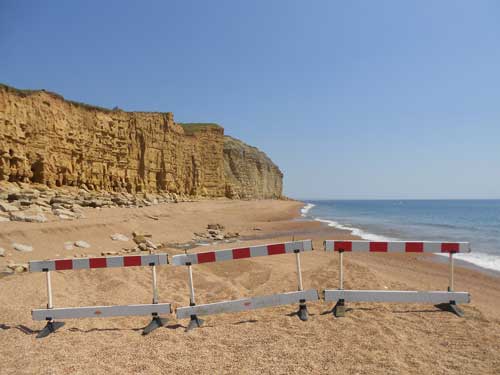
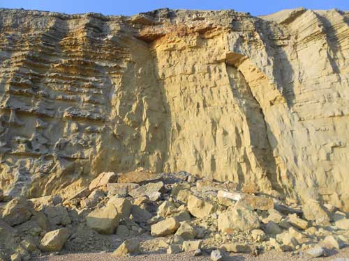
Access to the beach where the fatal landslide occurred was restricted while geologists assessed the immediate danger. BGS © UKRI (taken in 2012).
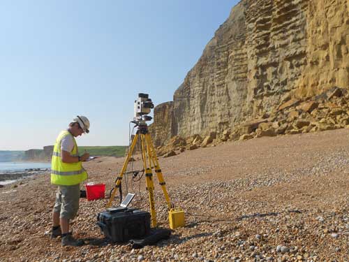
The Landslide Response Team mapped the collapsed cliff from a safe distance using a LiDAR scanner. BGS © UKRI (taken in 2012).
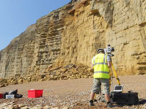
The Landslide Response Team mapped the collapsed cliff from a safe distance using a LiDAR scanner. BGS © UKRI (taken in 2012).
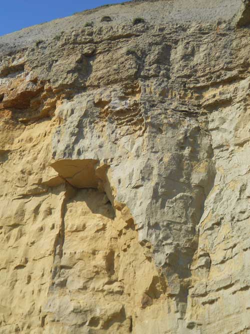
The presence of wide open cracks in cliff face provides a natural warning sign that cliffs may be unstable and potentially dangerous. BGS © UKRI (taken in 2012).
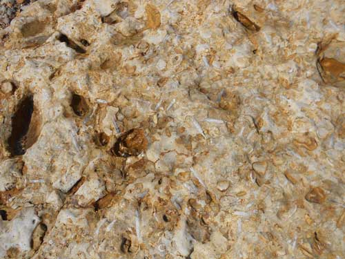
Fallen blocks of fossil-rich Jurassic limestone litter the beach along the World Heritage Jurassic Coast and attract fossil hunters. The public should exercise caution when standing under or at the top of cliffs and are advised to abide warning signs. BGS © UKRI (taken in 2012).
The 24 July 2012 rock fall at Burton Bradstock is a tragic reminder that the UK coastline is a dynamic and constantly changing part of our natural environment. BGS © UKRI (taken in 2012).
BGS’s initial findings suggest the recent heavy rain was a contributing factor that caused the rock fall at Burton Bradstock. BGS © UKRI (taken in 2012).
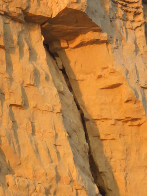
Wide cracks are visible in the rock face and leave unsupported blocks of rock free to fall. BGS © UKRI (taken in 2012).
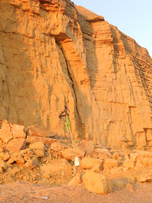
Wide cracks are visible in the rock face and leave unsupported blocks of rock free to fall. BGS © UKRI (taken in 2012).
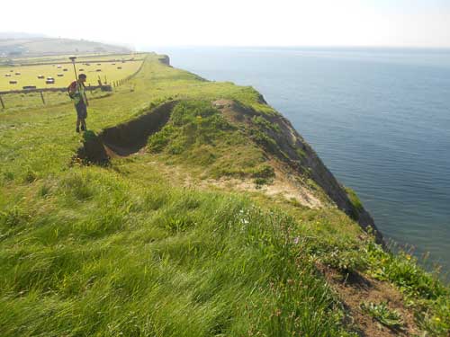
Sections of the South Coast Path were temporarily closed to allow geologists to assess the hazards. Ground cracks along cliff edges may indicate danger of instability and should not be approached. BGS © UKRI (taken in 2012).
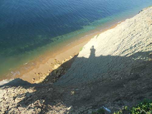
A view of the rock debris left by the rock fall. Debris eroded from cliffs naturally replenishes the beach sand, making coastal landslides an integral part of the coastal environment. BGS © UKRI (taken in 2012).
You may also be interested in

Landslide case studies
The landslides team at the BGS has studied numerous landslides. This work informs our geological maps, memoirs and sheet explanations and provides data for our National Landslide Database, which underpins much of our research.

Understanding landslides
What is a landslide? Why do landslides happen? How to classify a landslide. Landslides in the UK and around the world.

How to classify a landslide
Landslides are classified by their type of movement. The four main types of movement are falls, topples, slides and flows.

Landslides in the UK and around the world
Landslides in the UK, around the world and under the sea.