The Veolia Environmental Trust, with support from English Partnerships, commissioned the BGS to develop an ALERT system specifically for the automated time-lapse monitoring of landfills (Project RES/C/6034).
ALERT sensors would remotely detect temporal changes in leachate distribution, fluid and gas flow, hydrochemistry and saturation levels. This could lead to improved operational control of gas/leachate generation.
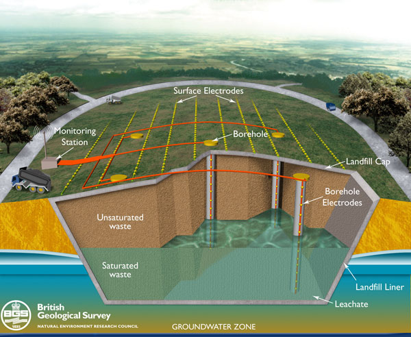

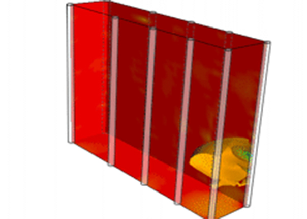
Figure 1: conceptual diagram showing a landfill cell instrumented with an ALERT station and resistivity monitoring arrays (red and green lines with electrodes in yellow).
Aims and objectives
The principal aim of the project was to develop a new, non-invasive, 4D, electrical imaging system for automated time-lapse monitoring of landfills. In situ sensors, data loggers and inversion software were developed to remotely detect temporal changes in leachate distribution, fluid and gas flow, hydrochemistry and saturation levels.
Specific objectives:
- adapt the BGS 3D resistivity imaging technology for long-term monitoring of landfills
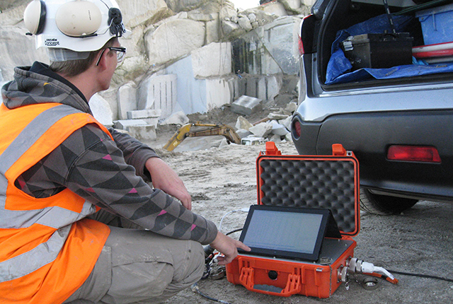
- design and develop a secure data-logger system with a telemetric link to the office for automatic time-lapse measurements (e.g. every week or on demand)
- develop existing 2D/3D inversion algorithms for fast 4D image reconstruction to improve sensitivity and detectability
- design and install an experimental site at field scale to demonstrate proof-of-concept
Experimental validation and results
As part of this research, the BGS has established a hydrogeophysical testing facility at our Keyworth site. This facility allows us to test the capability of the new 4D ALERT monitoring system during hydraulic experiments, such as tracer tests and flow simulations.
For saline tracer experiments, field-scale hydraulic test cells were filled with high-grade silica sand and equipped with boreholes and a pumping system. Two different borehole arrangements, a 2D arrangement with nine inline boreholes and a 3D arrangement with 3×3 boreholes, were tested. The propagation of the saline tracer was monitored remotely with the ALERT system.
ALERT was clearly able to trace the propagation of the plume on both borehole arrangements (Animations 1 and 2). In addition, the 3D arrangement allowed a volumetric reconstruction of the plume. Resistivity iso-surfaces were used to visualise the evolution of the experiment in 4D (Animation 2).
As a validation, the direct water sampling from multilevel sampling ports showed good agreement with the electrical images.
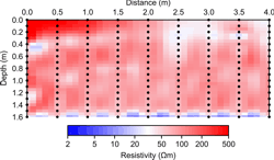
Animation 1: cross-borehole ERT using a fence of nine boreholes was used to generate a time-lapse 2D image of the conductive plume migrating along the test cell.
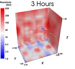
Animation 2: resistivity iso-surfaces were employed to visualise the evolution of the experiment in 4D.
Project partners
The Veolia Environmental Trust is a charity and an environmental body registered under the Landfill Tax Regulations established to protect, preserve and improve the environment for the benefit of the public.
The Veolia Environmental Group plc has supported Veolia Environmental Trust through its landfill operating companies by contributions of £28 million. To date, the Trust has awarded this money to over 480 projects nationally since its launch in 1997.
Contact
If you would like to discover more then please contact Oliver Kuras or Jonathan Chambers.
You may also be interested in
Contaminated land ALERT
Time-lapse geoelectrical imaging has the potential to produce volumetric, time-dependent maps of contaminant distributions for use in contaminated land remediation.
Applications
Applications range from mineral exploration and waste management, to monitoring active processes within the subsurface, such as the movement of pollutants, or the flow of groundwater in unstable slopes affecting infrastructure.