As part of a programme of work monitoring coastal erosion and landsliding at several sites around the coast of Great Britain, BGS has surveyed the cliffs at Beachy Head in Sussex using terrestrial LiDAR.

Beachy Head location map. BGS © UKRI.
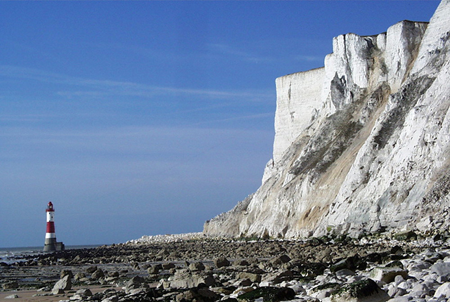
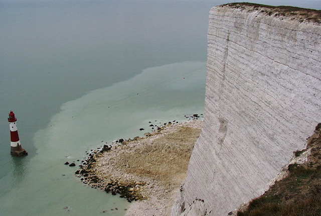
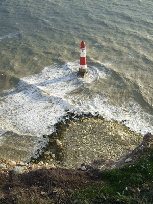
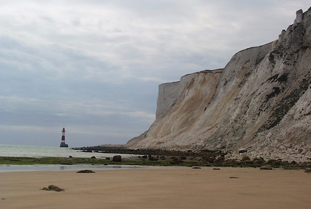
Figure 1: cliffs and lighthouse at Beachy Head. BGS © UKRI.

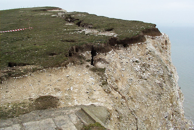
Figure 2: field sketch at Beachy Head. BGS © UKRI.
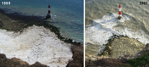
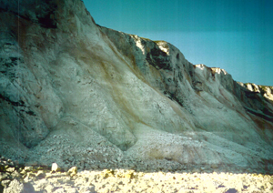
Figure 3: January 1999 landslide debris apron. Photographed July 1999 (left) and October 2007 (right) showing how the debris apron is still present after several years of erosion. BGS © UKRI.
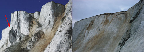
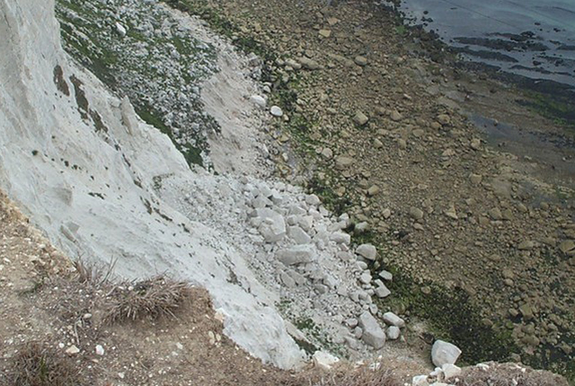
Figure 4: Devil’s Chimney before (left) and after (right) the landslide. BGS © UKRI.
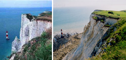
Figure 5: Devil’s Chimney before (left; © Bill Vanstone) and after (right: BGS © UKRI) the landslide
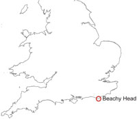
Beachy Head (figures 1 and 2) is a famous natural and historic site and tourist attraction on the south coast. The cliff top area is part of the Downland Country Park managed by Eastbourne District Council.
The section of cliff surveyed at Beachy Head is situated to the east of the modern lighthouse. The survey spans a 400 m, south-facing stretch of beach with a cliff height of between 120 and 160 m.
Geology
The geology of the cliffs at Beachy Head consists of Cretaceous chalk comprising the Seaford Chalk and Lewes Nodular Chalk formations (formerly called the Upper Chalk Formation) overlying the New Pit Chalk Formation (formerly part of the Middle Chalk).
The New Pit Chalk Formation (Turonian in age), in the lower part of the cliff, is largely obscured by chalk debris. This is principally blocky, white, firm to moderately hard chalk with numerous marls. Flint occurs sporadically or in seams in different part of the formation.
Overlying the New Pit Chalk Formation is the Lewes Nodular Chalk Formation, which is Turonian to Coniacian in age. This consists of hard, nodular chalk and chalkstone, which is locally porcellaneous. It has some interbeds of firm chalk, particularly in the upper part, and some thin marl seams including one at the base. The Lewes Nodular Chalk Formation is subdivided into 12 members, separated by marls or hardgrounds.
Overlying the Lewes Nodular Chalk Formation is the Seaford Chalk Formation. This is late Coniacian to early Santonian in age and consists of white chalk with beds of flint nodules, some of which are large to very large. It constitutes the entire cliff between Beachy Head lighthouse and Birling Gap to the west. It consists of three members: the Haven Brow Beds (upper), the Cuckmere Beds (middle) and the Belle Tout Beds (lower). The Bedwell’s Columnar Flint separates the Haven Brow and Cuckmere whilst the distinctive Seven Sisters Flint separates the Cuckmere and Belle Tout.
Landslides
On the foreshore, the chalk platform is littered with debris aprons from recent and earlier rockslides and rockfalls. The dominant landslide mechanism is a type of sliding failure with a very deep tension crack penetrating most of the Seaford Chalk Formation. This mechanism is described in Duperret et al. (2004) as being characteristic of cliffs in the Seaford Chalk and Lewes Nodular Chalk formations in England, and their equivalents in France, due to the prominent vertical and subvertical joint and fault patterns within these formations.
Two major landslide events have occurred at Beachy Head since 1999: one in January 1999 and one in April 2001.
January 1999 landslide
On the night of 10 January 1999, a large landslide occurred at Beachy Head, severing power and telecom cables from the cliff top bunker to the lighthouse. For several months, the failure required emergency manning procedures by Trinity House Lighthouse Service. The volume of this landslide is estimated to have been 128 000 m3 (Hobbs et al., 1999) and between 100 000 and 150 000 m3 (Mortimore et al., 2004). This landslide produced a large debris apron (Figure 2), which persists to the present day.
The lighthouse base is situated approximately 192 m from the cliff toe at high tide. The debris apron originally extended about 115 m from the cliff toe and came within 65 m of the lighthouse. The cliff at this point is 126 m high.
A further minor landslide occurred on 8 April 1999 and involved a displaced ‘slice’ of chalk left by the January slide.
Devil’s Chimney landslide, April 2001
This landslide occurred at 14:30 on 3 April 2001 and destroyed the landmark known as the Devil’s Chimney (Figures 3 and 4). The landslide followed three days of preliminary subsidence and detachment movements amounting to a displacement of a few metres.
A deep tension crack, probably penetrating the entire thickness of the Seaford Chalk Formation, developed following pre-existing joints. The separated block tilted seaward, further opening the tension crack and increasing the vertical stresses at its base. Debris and water were able to enter the fissure over many years, before the final slide when failure occurred. This failure is thought to have occurred in two stages separated by a few days or hours.
Gallery
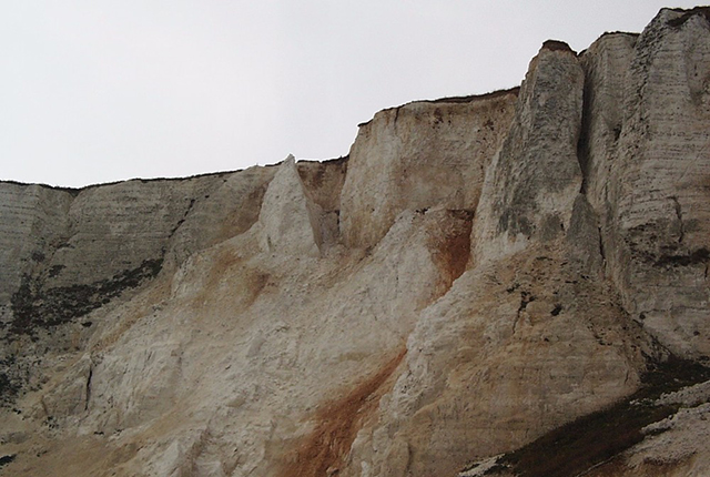
Beachy Head cliffs. BGS © UKRI.
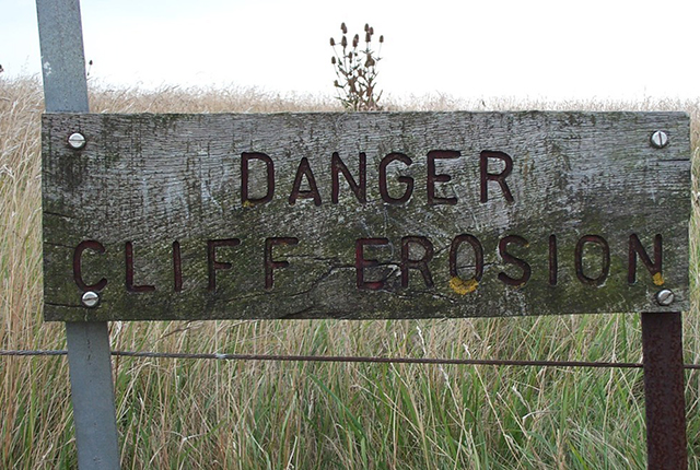
Warning sign at Beachy Head cliffs. BGS © UKRI.
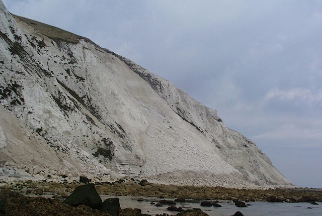
Beachy Head cliffs. BGS © UKRI.
Beachy Head cliffs. BGS © UKRI.
Beachy Head cliffs. BGS © UKRI.
Tension crack at top of Beachy Head cliffs. BGS © UKRI.
Debris fall at Beachy Head cliffs. BGS © UKRI.
Beachy Head lighthouse. BGS © UKRI.
Beachy Head lighthouse and cliffs. BGS © UKRI.
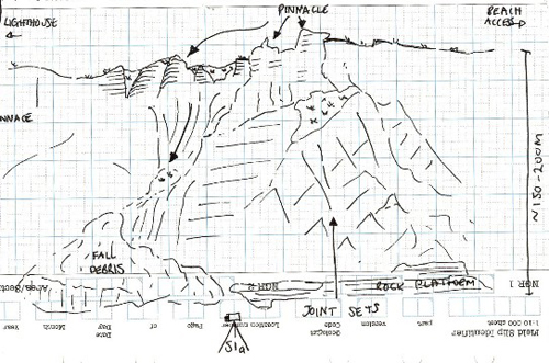
Field sketch of the debris fall. BGS © UKRI.
References
Duperret, A, Genter, A, Martinez, A, and Mortimore, R N. 2004. Coastal chalk cliff instability in NW France: role of lithology, fracture pattern and rainfall. 33–55 in Coastal Chalk Cliff Stability. Mortimore, R N, and Duperret, A (editors). Engineering Geology Special Publications. (London, UK: The Geological Society.)
Forster, A, Hobbs, P R N, and Flint, R C. 1999 Cliff stability and coastal landslides : rock slide at Beachy Head. 18–19 in Earthwise No. 14. (Nottingham, UK: British Geological Survey.)
Hobbs, P R N, Flint, R C, Balson, P S, Entwisle, D C, and Forster, A. 1999. Slope stability assessment of the cliff behind the Beachy Head lighthouse. British Geological Survey Technical Report WN/99/1C. (Nottingham, UK: British Geological Survey.)
Mortimore, R N, Stone, K J, Lawrence, J, and Duperret, A. 2004. Chalk physical properties and cliff instability. 75–88 in Coastal Chalk Cliff Stability. Mortimore, R N, and Duperret, A (editors). Engineering Geology Special Publications. (London, UK: The Geological Society.)
You may also be interested in

Landslide case studies
The landslides team at the BGS has studied numerous landslides. This work informs our geological maps, memoirs and sheet explanations and provides data for our National Landslide Database, which underpins much of our research.

Understanding landslides
What is a landslide? Why do landslides happen? How to classify a landslide. Landslides in the UK and around the world.

How to classify a landslide
Landslides are classified by their type of movement. The four main types of movement are falls, topples, slides and flows.

Landslides in the UK and around the world
Landslides in the UK, around the world and under the sea.