The Gault Formation (also known as the Gault Clay) is a sequence of clays, mudstone and thin siltstones with bands of phosphatic nodules deposited between 100 and 112 million years ago in the Cretaceous period. Its outcrop stretches south-westward from East Anglia through Wessex to west Dorset, and surrounds the Weald in an arc from north-east Kent westwards through Surrey to Hampshire, where it turns south and returns eastwards through West and East Sussex.
The study of the geotechnical properties in the database has shown that regional variations in the formation’s geotechnical properties exist. These variations appear to be largely a function of depositional environment, lithology and stress history.
Geological hazards and geotechnical problems
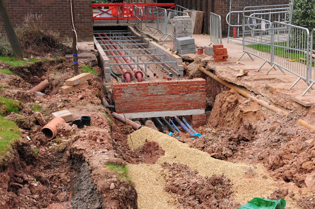
The Gault Formation has both ancient and recent landslides of shallow translational type with rotational elements at the back scarp and flows at the toe region. Multiple retrogressive rotational failures occur on some slopes. At major, inland escarpment or coastal cliffs, large, deep-seated landslide complexes have developed, as at Folkestone Warren near Dover and at Ventnor on the Isle of Wight.
The formation is prone to shrink–swell processes due to significant amounts of smectite clay in parts of its sequence. In the south-west, where it becomes siltier and more sandy, it is only of medium to high expansive potential; the remainder of the outcrop falls almost entirely in the very high expansive potential category.
The Gault Formation may contain aqueous solutions of sulphate and sulphuric acid in the ground in sufficient quantity for potential chemical attack on concrete.
Report download
The Engineering Geology of British Rocks and Soils: Gault Clay (50 MB PDF) provides an in-depth study of the Gault Formation using data held in the National Geotechnical Database.
The geological, lithological, geotechnical and mineralogical features of the Gault Formation have been described in detail, including geophysical correlation, groundwater considerations and implications for land-use and engineering construction.
Publications
Jones, L D, and Hobbs, P R N. 1998. The Shrinkage and Swelling Behaviour of UK Soils: Gault Clay. British Geological Survey Technical Report, WN/98/13. (Nottingham, UK; British Geological Survey.)
Forster, A, Hobbs, P R N, Cripps, A C, Entwisle, D C, Fenwick, S M M, Raines, M R, Hallam, J R, Jones, L D, Self, S J, and Meakin, J L. 1994. Engineering Geology of British Rocks and Soils: Gault Clay. British Geological Survey Technical Report, WN/94/31. (Nottingham, UK; British Geological Survey.)
Relative topics
You may also be interested in
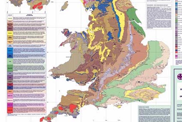
Engineering geology maps
BGS has produced 1:1 million-scale engineering geological maps of the UK, attributed with ‘engineering geological units’ in place of the traditional lithostratigraphical units.
Engineering geological studies of bedrock formations
Mapping the engineering geological characteristics, mineralogy, industrial applications, geological hazard potential, physical properties and behaviour of geological formations.