Potentially harmful chemical elements (PHEs), including arsenic (As), cadmium (Cd), chromium (Cr), nickel (Ni) and lead (Pb), occur in the environment and, under certain circumstances, can be harmful to plants, animals or people.
Whether or not a particular PHE constitutes a hazard depends on a variety of factors including:
- its chemical form, concentration, behaviour and the extent to which it may be taken up by living organisms
- the size of the mineral particles in which the element occurs
- soil or water acidity (pH)
- the type of vegetation cover
- the extent of exposure to the element
- the dose received
Some PHEs are widely distributed in natural (uncontaminated) soils as well as in a range of anthropogenic sources. PHEs exist in a range of inorganic forms that have varying toxicity.
What is the source of the data?
The estimated ambient background soil chemistry data is derived from G-BASE‘s rural soil geochemical data (where these are available). Elsewhere, the stream sediment data are converted to surface soil equivalent concentrations using delineations of Soil Parent Material Model polygons as the soil geochemistry mapping unit and the statistical relationships between soil and stream sediment data to derive the equivalent soil chemistry concentration from the stream sediment data. Where only Wolfson stream sediment data is available in southern England, this data is first transformed to G-BASE equivalent sediment concentrations and then to soil equivalent concentrations.
The urban soil chemistry data is derived from the results of soil geochemical surveys undertaken by the BGS. Nineteen of the surveys were undertaken as part of the G-BASE project, whereas Wolverhampton, Manchester and Glasgow were sampled as part of larger multidisciplinary projects and Greater London as part of the London Earth project.
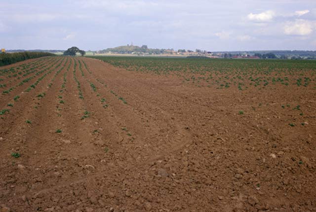

Honnington Farm, Lilleshall. The dark brown soil in the foreground represents glacial lake clay, this rests upon Lower Mottled Sandstone which gives the reddish-brown dry soil in the centre of the picture. The Lilleshall inlier of Precambrian and Cambrian rocks is visible in the background, and beyond that on the right the Enville Beds escarpment at Lilleshall Hall.
Who might require this data?
Anyone with a requirement to:
- conduct risk assessments based on the estimated concentration (mg kg-1) of As, Cd, Cr, Ni and Pb in topsoil
- establish whether elevated local measurements in urban areas may be the result of significant anthropogenic contamination by comparing data from the urban soil chemistry data with information on historic and current land use and with the estimated ambient background soil chemistry data derived from rural soil and stream sediment data
How does this data relate Defra’s normal background concentrations?
Defra commissioned the BGS (October 2011 to March 2012) to give guidance on what are normal levels of contaminants in English soils in support of the revision of the Part 2A Contaminated Land Statutory Guidance. The BGS soil chemistry for environmental assessments can be used to assess whether concentrations of elements at a site fall within the ‘normal’ level as defined in this guidance. ‘Normal levels’ for As, Cd, Ni and Pb in English soils are published in the technical guidance sheets and supplementary information.
‘Normal background concentration’ (NBC) is a term used to describe contaminant concentrations when they are seen as typical and encompasses contributions both from geogenic sources and diffuse anthropogenic pollution. NBCs should not be considered to cause land to qualify as contaminated land unless there is a particular reason to consider otherwise.
What is bioaccessibility?
The main exposure pathway for PHEs, including As and Pb in soil, is via soil ingestion by people, therefore, from a human health perspective, it is not the total amount of As or Pb in the soil but the fraction that is absorbed into the body during soil ingestion, i.e. the bioavailable fraction, that is important for assessing human health risk.
The relationship between the estimated ambient background soil chemistry and the urban soil chemistry
The measured urban soil chemistry dataset comprises the locations and concentrations (mg kg-1) of As, Cd, Cr, Ni and Pb in urban surface soil samples. These may differ from the values of the estimated ambient background soil chemistry as they are actual readings rather than estimates derived from rural soil and stream sediment data. As such, when used in conjunction with the estimated ambient background soil chemistry data, the results of the measured urban soil chemistry can establish whether elevated local measurements in urban areas are the result of significant anthropogenic contamination, or whether they are representative of the estimated ambient background concentration.
Have the datasets changed their name?
Yes. We have re-named our soil chemistry datasets thus:
- The national soil chemistry dataset is now the estimated ambient background soil chemistry data.
- The urban soil chemistry data remains as is, but has been subdivided into:
- the measured urban soil chemistry dataset (representing the actual location and concentrations of As, Cd, Cr, Ni and Pb in topsoil samples)
- the estimated urban soil chemistry dataset (representing the estimated geometric mean concentrations (mg kg-1) of As, Cd, Cr, Ni and Pb in topsoil derived by spatial interpolation of the measured urban soil chemistry dataset
The estimated ambient background soil chemistry data and the urban soil chemistry datasets together now make up the soil chemistry for environmental assessments data package.
You may also be interested in
Soil chemistry for environmental assessments
This dataset contains estimated ambient background concentrations of potentially harmful elements for rural and selected urban topsoils.
Soil Parent Material Model
The Soil Parent Material Model details the distribution of properties of the weathered and unweathered soil parent materials of Great Britain.