The A83, known as the Rest and Be Thankful Pass, is an important trunk road in Argyll and Bute in Scotland. It is to the west of Loch Lomond and is the main route to towns and villages in southern Argyll from Glasgow. The landslide was located 8 km west of Arrochar on the A83.
This is the second time the road has been closed at this location in the last two years; on the previous occasion, the road was closed for two weeks. The BGS Landslide Response Team surveyed the first landslide in October 2007.
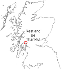

Rest and Be Thankful (A83) location map. BGS © UKRI.
After a sustained period of heavy rain, some time on the morning of 8 September 2009, a landslide occurred that blocked the road for two days, causing a 55-mile detour.
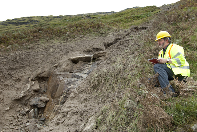
The BGS Landslide Response Team made a visit to the landslide on 10 September 2009 to investigate the failure. Information was collected for the BGS National Landslide Database and to update our geological maps.
Rest And Be Thankful landslide (2009). BGS © UKRI.
News reports
The landslides on the Rest and Be Thankful Pass have been widely reported in the local and national news.
2009 landslide
- Work to clear landslide BBC video and report 09 September 2009
- Landslip as winds batter Scotland BBC news report, 08 September 2009
2007 landslide
- Road open after landslide cleared BBC news report, 09 November 2007
- ‘Flat out’ efforts to reopen A83 BBC news report, 05 November 2007
- Controlled landslip may clear A83 BBC news report, 02 November 2007
- Road closed after major landslide BBC news report, 28 October 2007
Geology
The area in which the 2007 and 2009 failures have occurred is steeply sloping ground underlain by rocks of the Beinn Bheula Schist Formation. These are composed of psammite and semi-pelitic rocks that are metamorphic in origin. These are composed largely of quartz, feldspar and mica minerals. These rocks are commonly intensely foliated and spectacularly folded; extensive quartz lenses and veins also occur.
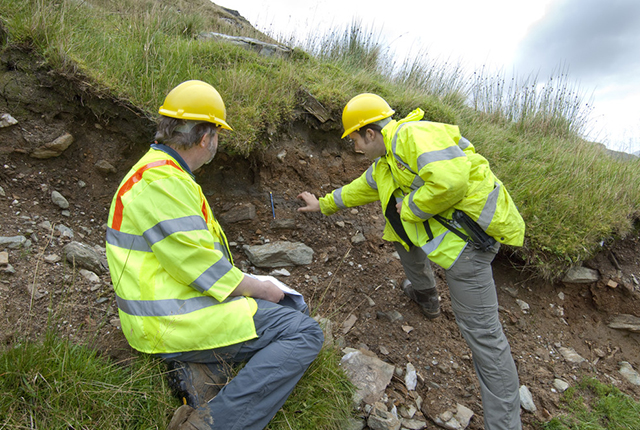
The bedrock plays little part in the landslide activity on these slopes. The recent landslides here have largely been associated with slope deposits, including peat and topsoil, as well as the underlying layers of colluvium, comprising sandy to gravelly silts and clays, with varying amounts of cobbles and boulders. The colluvium deposits on this slope represent earlier phases of slope instability.
Rest And Be Thankful landslide (2009). BGS © UKRI.
BGS © UKRI.
Landslide
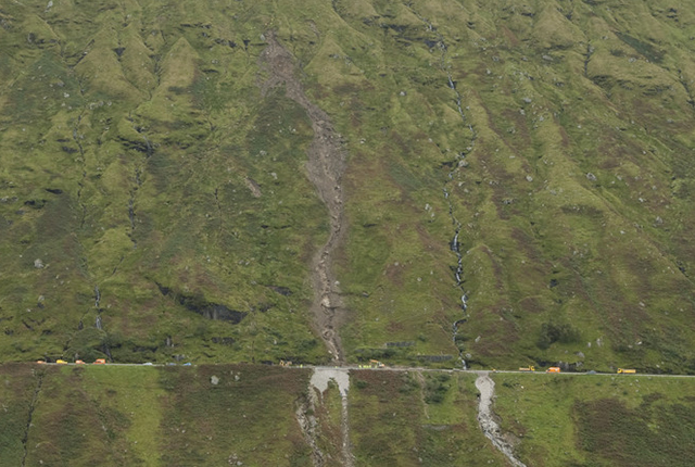
This landslide (National Landslide Database ID 15757/2) is classified as a debris flow, which has followed an existing drainage line. The source of the debris was traced to an area on the slope high above the road, where rafts of soil had become detached and broken up. These fed debris into the drainage line. Some rafts of debris moved only a short distance, however, and still remain near their source. The debris flow also scoured material from the drainage channel as it moved rapidly down slope.
The debris and water exceeded the capacity of the drainage of the road, causing the debris to be deposited on the road itself, blocking the whole carriageway.
A debris flow at the same location in 2007 caused a similar blockage. BGS Landslide Response Team geologists were able to make good use of their observations and excellent photographic records of the event in 2007 to demonstrate how instability of the slope has moved to a higher level and to new locations. It seems likely, however, that the 2009 landslide was influenced by much older landslide features on the slope.
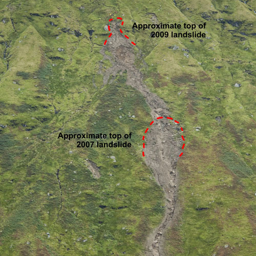
Material in 2009 came from higher up the slope than the 2007 landslide. BGS © UKRI.
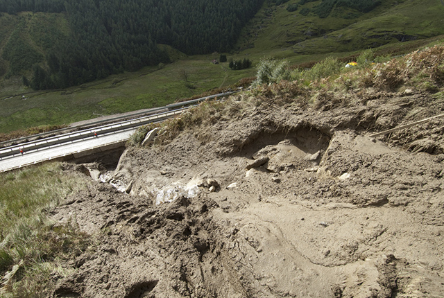
View down the debris flow to the road (A83). BGS © UKRI.
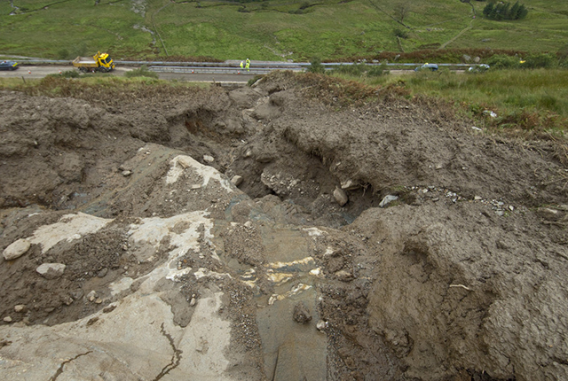
Gully left by the rapidly moving debris flow. BGS © UKRI.
At the top of the 2009 landslide. BGS © UKRI.
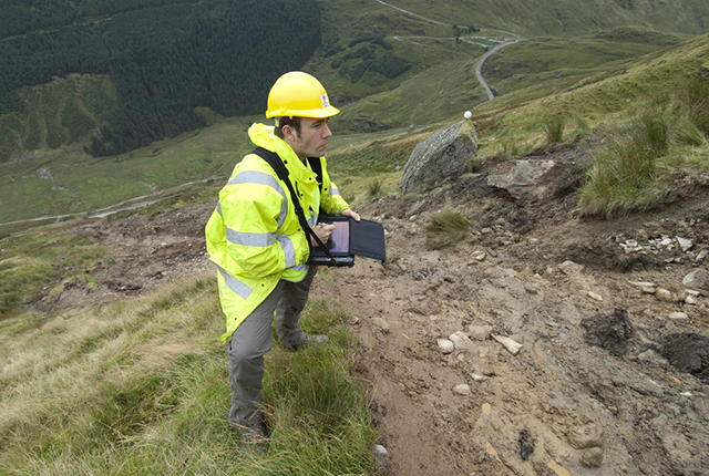
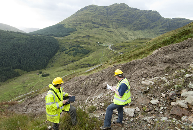
BGS Landslide Response Team using BGS·SIGMAmobile technology to collect information about the landslide. BGS © UKRI.
You may also be interested in

Landslide case studies
The landslides team at the BGS has studied numerous landslides. This work informs our geological maps, memoirs and sheet explanations and provides data for our National Landslide Database, which underpins much of our research.

Understanding landslides
What is a landslide? Why do landslides happen? How to classify a landslide. Landslides in the UK and around the world.

How to classify a landslide
Landslides are classified by their type of movement. The four main types of movement are falls, topples, slides and flows.

Landslides in the UK and around the world
Landslides in the UK, around the world and under the sea.